

Hinterland
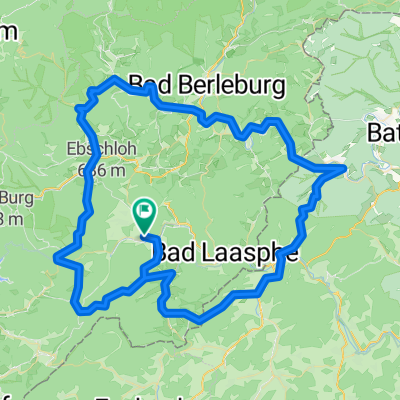
Zum Edertalradweg und durchs Hinterland
A cycling route starting in Erndtebrück, North Rhine-Westphalia, Germany.
Overview
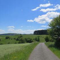
About this route
Feudingen-Amtshausen-Berghausen- Edertalradweg to behind Hatzfeld-Eifa-Dexbach-Treisbach-Warzenbach-Caldern-Damshausen-Bottenhorn-Breidenbach-Hesselbach-Banfe-Ilsetal
- -:--
- Duration
- 114.7 km
- Distance
- 989 m
- Ascent
- 989 m
- Descent
- ---
- Avg. speed
- ---
- Max. altitude

Part of
Hinterland
12 stages
Route quality
Waytypes & surfaces along the route
Waytypes
Road
25.2 km
(22 %)
Quiet road
17.2 km
(15 %)
Surfaces
Paved
56.2 km
(49 %)
Unpaved
8 km
(7 %)
Asphalt
52.8 km
(46 %)
Loose gravel
4.6 km
(4 %)
Continue with Bikemap
Use, edit, or download this cycling route
You would like to ride Zum Edertalradweg und durchs Hinterland or customize it for your own trip? Here is what you can do with this Bikemap route:
Free features
- Save this route as favorite or in collections
- Copy & plan your own version of this route
- Split it into stages to create a multi-day tour
- Sync your route with Garmin or Wahoo
Premium features
Free trial for 3 days, or one-time payment. More about Bikemap Premium.
- Navigate this route on iOS & Android
- Export a GPX / KML file of this route
- Create your custom printout (try it for free)
- Download this route for offline navigation
Discover more Premium features.
Get Bikemap PremiumFrom our community
Other popular routes starting in Erndtebrück
 2. Lahnquelle - Marburg
- Distance
- 67.3 km
- Ascent
- 539 m
- Descent
- 945 m
- Location
- Erndtebrück, North Rhine-Westphalia, Germany
 lahntal feudingen-koblenz
- Distance
- 250.8 km
- Ascent
- 2,199 m
- Descent
- 2,514 m
- Location
- Erndtebrück, North Rhine-Westphalia, Germany
 lLahnradweg neu 22.03.2019
- Distance
- 194.1 km
- Ascent
- 721 m
- Descent
- 1,255 m
- Location
- Erndtebrück, North Rhine-Westphalia, Germany
 Lahn 2014
- Distance
- 217.3 km
- Ascent
- 2,614 m
- Descent
- 3,025 m
- Location
- Erndtebrück, North Rhine-Westphalia, Germany
 5 Bäche-Tour: Eder, Lahn, Perf, Banfe + Ilse
- Distance
- 104.4 km
- Ascent
- 909 m
- Descent
- 912 m
- Location
- Erndtebrück, North Rhine-Westphalia, Germany
 Lahntal-Radweg
- Distance
- 245.8 km
- Ascent
- 235 m
- Descent
- 781 m
- Location
- Erndtebrück, North Rhine-Westphalia, Germany
 Ilsetal-Edertal-R8-Perftalsee-Banfetal
- Distance
- 100.9 km
- Ascent
- 751 m
- Descent
- 750 m
- Location
- Erndtebrück, North Rhine-Westphalia, Germany
 Ferndorfquelle
- Distance
- 15.7 km
- Ascent
- 270 m
- Descent
- 258 m
- Location
- Erndtebrück, North Rhine-Westphalia, Germany
Open it in the app