

Into the clouds, La Fortuna - Monteverde XTREME ride
A cycling route starting in La Fortuna, Alajuela Province, Costa Rica.
Overview
About this route
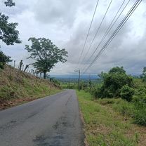
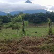
Costa Rica cycling, the perfect way to learn to know our beautiful country, for those riders who like tho challenge them selve this is a route you cannot mis out on. Beautiful far sights, rough climbs, river crossings, allone in the mountains crossing the transition area between Caribic and pacific coast!
Want to know more check out www.costaricacycling.com or send an email to info@costaricacycling.com to start your Costa Rica adventure on the right track!
- -:--
- Duration
- 82.5 km
- Distance
- 1,559 m
- Ascent
- 764 m
- Descent
- ---
- Avg. speed
- ---
- Max. altitude

Route quality
Waytypes & surfaces along the route
Waytypes
Road
37.1 km
(45 %)
Quiet road
30.5 km
(37 %)
Surfaces
Paved
27.2 km
(33 %)
Unpaved
46.2 km
(56 %)
Asphalt
27.2 km
(33 %)
Gravel
18.2 km
(22 %)
Continue with Bikemap
Use, edit, or download this cycling route
You would like to ride Into the clouds, La Fortuna - Monteverde XTREME ride or customize it for your own trip? Here is what you can do with this Bikemap route:
Free features
- Save this route as favorite or in collections
- Copy & plan your own version of this route
- Split it into stages to create a multi-day tour
- Sync your route with Garmin or Wahoo
Premium features
Free trial for 3 days, or one-time payment. More about Bikemap Premium.
- Navigate this route on iOS & Android
- Export a GPX / KML file of this route
- Create your custom printout (try it for free)
- Download this route for offline navigation
Discover more Premium features.
Get Bikemap PremiumFrom our community
Other popular routes starting in La Fortuna
 De Calle 444, La Fortuna a Calle 444, La Fortuna
- Distance
- 13.3 km
- Ascent
- 184 m
- Descent
- 183 m
- Location
- La Fortuna, Alajuela Province, Costa Rica
 chachagua
- Distance
- 18.3 km
- Ascent
- 367 m
- Descent
- 376 m
- Location
- La Fortuna, Alajuela Province, Costa Rica
 De Alajuela Province a Calle Arenal Observatory Lodge
- Distance
- 23.9 km
- Ascent
- 605 m
- Descent
- 143 m
- Location
- La Fortuna, Alajuela Province, Costa Rica
 Paseo tranquilo
- Distance
- 14.7 km
- Ascent
- 200 m
- Descent
- 186 m
- Location
- La Fortuna, Alajuela Province, Costa Rica
 La Fortuna
- Distance
- 19.6 km
- Ascent
- 199 m
- Descent
- 200 m
- Location
- La Fortuna, Alajuela Province, Costa Rica
 A09 SpringsResort Fortuna
- Distance
- 27.4 km
- Ascent
- 555 m
- Descent
- 557 m
- Location
- La Fortuna, Alajuela Province, Costa Rica
 Montana de fuego-Nvo arenal
- Distance
- 38.2 km
- Ascent
- 649 m
- Descent
- 410 m
- Location
- La Fortuna, Alajuela Province, Costa Rica
 RIDE ARENAL - 25k
- Distance
- 12.5 km
- Ascent
- 248 m
- Descent
- 177 m
- Location
- La Fortuna, Alajuela Province, Costa Rica
Open it in the app