

Long ride through Massillargues-Attuech
A cycling route starting in Saint-Étienne-de-Fontbellon, Auvergne-Rhône-Alpes, France.
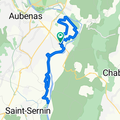
Overview
About this route
Beautiful, Nice First part too vallon pont d'arc. but too much car and truck on the second part.
- 5 h 23 min
- Duration
- 101.4 km
- Distance
- 598 m
- Ascent
- 670 m
- Descent
- 18.8 km/h
- Avg. speed
- ---
- Max. altitude

Route photos

Route quality
Waytypes & surfaces along the route
Waytypes
Busy road
57.9 km
(57 %)
Road
21.1 km
(21 %)
Surfaces
Paved
67.1 km
(66 %)
Unpaved
2.8 km
(3 %)
Asphalt
67.1 km
(66 %)
Gravel
2.6 km
(3 %)
Continue with Bikemap
Use, edit, or download this cycling route
You would like to ride Long ride through Massillargues-Attuech or customize it for your own trip? Here is what you can do with this Bikemap route:
Free features
- Save this route as favorite or in collections
- Copy & plan your own version of this route
- Split it into stages to create a multi-day tour
- Sync your route with Garmin or Wahoo
Premium features
Free trial for 3 days, or one-time payment. More about Bikemap Premium.
- Navigate this route on iOS & Android
- Export a GPX / KML file of this route
- Create your custom printout (try it for free)
- Download this route for offline navigation
Discover more Premium features.
Get Bikemap PremiumFrom our community
Other popular routes starting in Saint-Étienne-de-Fontbellon
 Etape 2
- Distance
- 96.5 km
- Ascent
- 633 m
- Descent
- 698 m
- Location
- Saint-Étienne-de-Fontbellon, Auvergne-Rhône-Alpes, France
 ailh
ailh- Distance
- 10.9 km
- Ascent
- 333 m
- Descent
- 327 m
- Location
- Saint-Étienne-de-Fontbellon, Auvergne-Rhône-Alpes, France
 ten miler ailhon
- Distance
- 17.1 km
- Ascent
- 419 m
- Descent
- 407 m
- Location
- Saint-Étienne-de-Fontbellon, Auvergne-Rhône-Alpes, France
 vélo Aubenas
- Distance
- 37.4 km
- Ascent
- 509 m
- Descent
- 496 m
- Location
- Saint-Étienne-de-Fontbellon, Auvergne-Rhône-Alpes, France
 Aub_Loubaresse_100K
- Distance
- 106.7 km
- Ascent
- 1,479 m
- Descent
- 1,472 m
- Location
- Saint-Étienne-de-Fontbellon, Auvergne-Rhône-Alpes, France
 aubenas largentiere
- Distance
- 29.9 km
- Ascent
- 320 m
- Descent
- 304 m
- Location
- Saint-Étienne-de-Fontbellon, Auvergne-Rhône-Alpes, France
 Test St Didier
- Distance
- 15.7 km
- Ascent
- 65 m
- Descent
- 68 m
- Location
- Saint-Étienne-de-Fontbellon, Auvergne-Rhône-Alpes, France
 Long ride through Massillargues-Attuech
- Distance
- 101.4 km
- Ascent
- 598 m
- Descent
- 670 m
- Location
- Saint-Étienne-de-Fontbellon, Auvergne-Rhône-Alpes, France
Open it in the app