
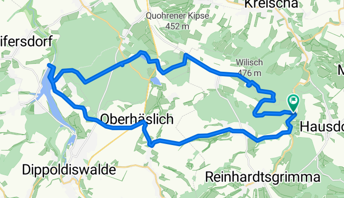


Wilisch und Dippoldiswalde Heide
- 24.7 km
- 339 m
- 346 m
- Reinhardtsgrimma, Saxony, Germany
A cycling route starting in Reinhardtsgrimma, Saxony, Germany.
Overview
The starting point is the car park behind the Teufelsmühle. The route goes up alongside the Hirschbach to the Wilisch.
The next destination is the Dippoldiswalder Heide and the Malter Reservoir.
Return via country roads to Hirschbauch and then on to the car park.
created this 8 years ago
Continue with Bikemap
You would like to ride Wilisch und Dippoldiswalde Heide or customize it for your own trip? Here is what you can do with this Bikemap route:
Free trial for 3 days, or one-time payment. More about Bikemap Premium.
Discover more Premium features.
Get Bikemap PremiumFrom our community
Open it in the app


