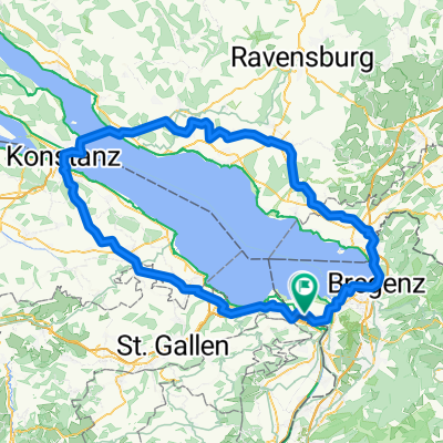
Rheineck -Bisel
A cycling route starting in Rheineck, Canton of St. Gallen, Switzerland.
Overview
About this route
- -:--
- Duration
- 212.2 km
- Distance
- 873 m
- Ascent
- 861 m
- Descent
- ---
- Avg. speed
- ---
- Avg. speed
Continue with Bikemap
Use, edit, or download this cycling route
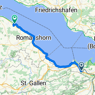
You would like to ride Rheineck -Bisel or customize it for your own trip? Here is what you can do with this Bikemap route:
Free features
- Save this route as favorite or in collections
- Copy & plan your own version of this route
- Sync your route with Garmin or Wahoo
Premium features
Free trial for 3 days, or one-time payment. More about Bikemap Premium.
- Navigate this route on iOS & Android
- Export a GPX / KML file of this route
- Create your custom printout (try it for free)
- Download this route for offline navigation
Discover more Premium features.
Get Bikemap PremiumFrom our community
Other popular routes starting in Rheineck
- 15_Alter Rhein
- Distance
- 59.8 km
- Ascent
- 139 m
- Descent
- 139 m
- Location
- Rheineck, Canton of St. Gallen, Switzerland
- LB-Höchst-Au-Walzenhausen-LB
- Distance
- 26.7 km
- Ascent
- 344 m
- Descent
- 344 m
- Location
- Rheineck, Canton of St. Gallen, Switzerland
- Vorarlberg - Wien
- Distance
- 659.6 km
- Ascent
- 2,077 m
- Descent
- 2,231 m
- Location
- Rheineck, Canton of St. Gallen, Switzerland
- E01 Rheineck - Eschenz
- Distance
- 77.5 km
- Ascent
- 79 m
- Descent
- 54 m
- Location
- Rheineck, Canton of St. Gallen, Switzerland
- vacation 2015
- Distance
- 836 km
- Ascent
- 2,387 m
- Descent
- 3,836 m
- Location
- Rheineck, Canton of St. Gallen, Switzerland
- Rheineck -Bisel
- Distance
- 212.2 km
- Ascent
- 873 m
- Descent
- 861 m
- Location
- Rheineck, Canton of St. Gallen, Switzerland
- Eggersriet Höhe XL
- Distance
- 28.3 km
- Ascent
- 1,247 m
- Descent
- 751 m
- Location
- Rheineck, Canton of St. Gallen, Switzerland
- Appenzell 1
- Distance
- 42.7 km
- Ascent
- 888 m
- Descent
- 888 m
- Location
- Rheineck, Canton of St. Gallen, Switzerland
Open it in the app