

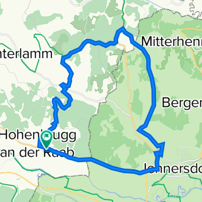
Stoagupfrunde
A cycling route starting in Unterlamm, Styria, Austria.
Overview
About this route
- -:--
- Duration
- 14.9 km
- Distance
- 284 m
- Ascent
- 286 m
- Descent
- ---
- Avg. speed
- ---
- Max. altitude

Route highlights
Points of interest along the route

Photo after 3.8 km
Continue with Bikemap
Use, edit, or download this cycling route
You would like to ride Stoagupfrunde or customize it for your own trip? Here is what you can do with this Bikemap route:
Free features
- Save this route as favorite or in collections
- Copy & plan your own version of this route
- Sync your route with Garmin or Wahoo
Premium features
Free trial for 3 days, or one-time payment. More about Bikemap Premium.
- Navigate this route on iOS & Android
- Export a GPX / KML file of this route
- Create your custom printout (try it for free)
- Download this route for offline navigation
Discover more Premium features.
Get Bikemap PremiumFrom our community
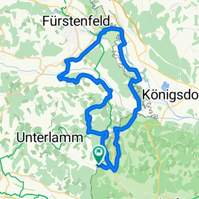
Other popular routes starting in Unterlamm
 Hohenbrugg an der Raab 145, Hohenbrugg an der Raab nach Hohenbrugg an der Raab 145, Hohenbrugg an der Raab
- Distance
- 21.4 km
- Ascent
- 374 m
- Descent
- 375 m
- Location
- Unterlamm, Styria, Austria
 Riegersburgtour
- Distance
- 57 km
- Ascent
- 641 m
- Descent
- 644 m
- Location
- Unterlamm, Styria, Austria
 Mühlentour
- Distance
- 35.5 km
- Ascent
- 489 m
- Descent
- 490 m
- Location
- Unterlamm, Styria, Austria
 Unterlamm 33, Unterlamm nach Scheiberbuchweg, Unterlamm
- Distance
- 0.4 km
- Ascent
- 3 m
- Descent
- 4 m
- Location
- Unterlamm, Styria, Austria
 2013.08.04 Omiš 3 Magland - Spielfield Eurovelo 9
- Distance
- 94.4 km
- Ascent
- 480 m
- Descent
- 376 m
- Location
- Unterlamm, Styria, Austria
 Stoagupfrunde
- Distance
- 14.9 km
- Ascent
- 284 m
- Descent
- 286 m
- Location
- Unterlamm, Styria, Austria
 Magland Loipersdorf
- Distance
- 4.1 km
- Ascent
- 116 m
- Descent
- 51 m
- Location
- Unterlamm, Styria, Austria
 Lufttour 1
- Distance
- 68.7 km
- Ascent
- 655 m
- Descent
- 685 m
- Location
- Unterlamm, Styria, Austria
Open it in the app