

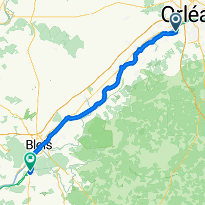
LA LOIRE-LA CHAPELLE-CHATEAUNEUF-100KM
A cycling route starting in Saint-Hilaire-Saint-Mesmin, Centre-Val de Loire, France.
Overview
About this route
- -:--
- Duration
- 100.7 km
- Distance
- 122 m
- Ascent
- 125 m
- Descent
- ---
- Avg. speed
- ---
- Max. altitude

Route quality
Waytypes & surfaces along the route
Waytypes
Quiet road
43.3 km
(43 %)
Path
17.1 km
(17 %)
Surfaces
Paved
44.3 km
(44 %)
Unpaved
25.2 km
(25 %)
Asphalt
40.3 km
(40 %)
Ground
12.1 km
(12 %)
Continue with Bikemap
Use, edit, or download this cycling route
You would like to ride LA LOIRE-LA CHAPELLE-CHATEAUNEUF-100KM or customize it for your own trip? Here is what you can do with this Bikemap route:
Free features
- Save this route as favorite or in collections
- Copy & plan your own version of this route
- Split it into stages to create a multi-day tour
- Sync your route with Garmin or Wahoo
Premium features
Free trial for 3 days, or one-time payment. More about Bikemap Premium.
- Navigate this route on iOS & Android
- Export a GPX / KML file of this route
- Create your custom printout (try it for free)
- Download this route for offline navigation
Discover more Premium features.
Get Bikemap PremiumFrom our community
Other popular routes starting in Saint-Hilaire-Saint-Mesmin
 LA LOIRE-LA CHAPELLE-CHATEAUNEUF-100KM
- Distance
- 100.7 km
- Ascent
- 122 m
- Descent
- 125 m
- Location
- Saint-Hilaire-Saint-Mesmin, Centre-Val de Loire, France
 floral et monumental
- Distance
- 48.6 km
- Ascent
- 135 m
- Descent
- 133 m
- Location
- Saint-Hilaire-Saint-Mesmin, Centre-Val de Loire, France
 100 Rue de l'Église, Saint-Hilaire-Saint-Mesmin à 150 Rue des Capucines, Olivet
- Distance
- 7.8 km
- Ascent
- 19 m
- Descent
- 12 m
- Location
- Saint-Hilaire-Saint-Mesmin, Centre-Val de Loire, France
 Loire heen
- Distance
- 505.7 km
- Ascent
- 231 m
- Descent
- 287 m
- Location
- Saint-Hilaire-Saint-Mesmin, Centre-Val de Loire, France
 entre vignes et vergers de la Loire
- Distance
- 23.8 km
- Ascent
- 32 m
- Descent
- 34 m
- Location
- Saint-Hilaire-Saint-Mesmin, Centre-Val de Loire, France
 Sdaint-Hilaire-Saint-Mesmin bis Chailles
- Distance
- 65.3 km
- Ascent
- 124 m
- Descent
- 133 m
- Location
- Saint-Hilaire-Saint-Mesmin, Centre-Val de Loire, France
 99 Rue du Bouillon, Saint-Hilaire-Saint-Mesmin à 7 Avenue du Traité de Rome, Saint-Pryvé-Saint-Mesmin
- Distance
- 2.8 km
- Ascent
- 14 m
- Descent
- 19 m
- Location
- Saint-Hilaire-Saint-Mesmin, Centre-Val de Loire, France
 route anto.jpg
- Distance
- 80.7 km
- Ascent
- 103 m
- Descent
- 103 m
- Location
- Saint-Hilaire-Saint-Mesmin, Centre-Val de Loire, France
Open it in the app