

00000 rra5 3
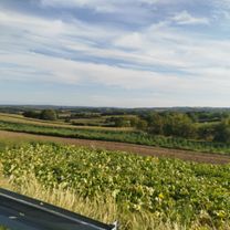
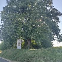
A cycling route starting in Kańczuga, Subcarpathian Voivodeship, Poland.
Overview
About this route
- -:--
- Duration
- 29 km
- Distance
- 198 m
- Ascent
- 182 m
- Descent
- ---
- Avg. speed
- ---
- Max. altitude

Route quality
Waytypes & surfaces along the route
Waytypes
Road
18 km
(62 %)
Quiet road
5.6 km
(19 %)
Surfaces
Paved
21.7 km
(75 %)
Unpaved
0.8 km
(3 %)
Asphalt
21.7 km
(75 %)
Gravel
0.8 km
(3 %)
Undefined
6.5 km
(22 %)
Continue with Bikemap
Use, edit, or download this cycling route
You would like to ride 00000 rra5 3 or customize it for your own trip? Here is what you can do with this Bikemap route:
Free features
- Save this route as favorite or in collections
- Copy & plan your own version of this route
- Sync your route with Garmin or Wahoo
Premium features
Free trial for 3 days, or one-time payment. More about Bikemap Premium.
- Navigate this route on iOS & Android
- Export a GPX / KML file of this route
- Create your custom printout (try it for free)
- Download this route for offline navigation
Discover more Premium features.
Get Bikemap PremiumFrom our community
Other popular routes starting in Kańczuga
 Szkolna do Wolności
- Distance
- 21 km
- Ascent
- 225 m
- Descent
- 276 m
- Location
- Kańczuga, Subcarpathian Voivodeship, Poland
 Kańczuga Łopuszka Manasterz SIetesz. Podparpackie pogórze
- Distance
- 38.8 km
- Ascent
- 470 m
- Descent
- 470 m
- Location
- Kańczuga, Subcarpathian Voivodeship, Poland
 #2 GSR "Junior"
- Distance
- 17.3 km
- Ascent
- 145 m
- Descent
- 137 m
- Location
- Kańczuga, Subcarpathian Voivodeship, Poland
 68 km Gminny Szlak Rowerowy "K-ga Max" (Kańczucka pętla)
- Distance
- 68.2 km
- Ascent
- 710 m
- Descent
- 715 m
- Location
- Kańczuga, Subcarpathian Voivodeship, Poland
 Trasa od bajeczna, kańczuga do bajeczna, kańczuga
- Distance
- 100.1 km
- Ascent
- 563 m
- Descent
- 563 m
- Location
- Kańczuga, Subcarpathian Voivodeship, Poland
 # 3 GSR "EDU 9"
- Distance
- 43.2 km
- Ascent
- 380 m
- Descent
- 388 m
- Location
- Kańczuga, Subcarpathian Voivodeship, Poland
 130 (55/16) Rudołowice-Radymno-Wiązownica-Radawa-Sieniawa-Przeworsk
- Distance
- 133.9 km
- Ascent
- 258 m
- Descent
- 260 m
- Location
- Kańczuga, Subcarpathian Voivodeship, Poland
 Zielona do Węgierska 39A
- Distance
- 19 km
- Ascent
- 163 m
- Descent
- 204 m
- Location
- Kańczuga, Subcarpathian Voivodeship, Poland
Open it in the app