

Gevenich Nürburgring zurück
A cycling route starting in Weiler, Rhineland-Palatinate, Germany.
Overview
About this route
<p>Route:</p>
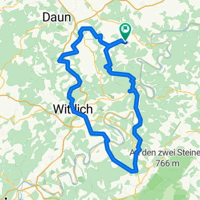
<p>Gevenich-Büchel-Alflen-Auderath-Ulmen-Höchstberg-Kaperich-Uersfeld-Retterath-Salcherath-Mannebach-Hünerbach-Reimerath-Welcherath-Meuspath-Breidscheid-Adenau-Wimbach-Kottenborn-B257-'Potsdammer Platz'-B258-Wiesemscheid-Meisenthal-Rotenbach-Bodenbach--Borler-L70-Bongard-Kelberg-Köttelbach-Mosbruch-Ueß-Hörschhausen-Gefell-Samersbach-Darscheid-Steiningen-Steineberg-Ellscheid-Winkel-Wollmerath-Gillenbeuren-Driesch-Gevenich</p>
Translated, show original (German)- -:--
- Duration
- 124.6 km
- Distance
- 1,366 m
- Ascent
- 1,366 m
- Descent
- ---
- Avg. speed
- ---
- Max. altitude

Route highlights
Points of interest along the route
Point of interest after 14 km
Gevenich Nürburgring
Point of interest after 14 km
Continue with Bikemap
Use, edit, or download this cycling route
You would like to ride Gevenich Nürburgring zurück or customize it for your own trip? Here is what you can do with this Bikemap route:
Free features
- Save this route as favorite or in collections
- Copy & plan your own version of this route
- Split it into stages to create a multi-day tour
- Sync your route with Garmin or Wahoo
Premium features
Free trial for 3 days, or one-time payment. More about Bikemap Premium.
- Navigate this route on iOS & Android
- Export a GPX / KML file of this route
- Create your custom printout (try it for free)
- Download this route for offline navigation
Discover more Premium features.
Get Bikemap PremiumFrom our community
Other popular routes starting in Weiler
 Hunsrück- und Eifeltour
- Distance
- 116.9 km
- Ascent
- 1,264 m
- Descent
- 1,263 m
- Location
- Weiler, Rhineland-Palatinate, Germany
 Vulkaneifelrunde Gevenich-Ulmen-Demerath-Winkel-Lutzerath-Gevenich CLONED FROM ROUTE 81303
- Distance
- 58.5 km
- Ascent
- 604 m
- Descent
- 604 m
- Location
- Weiler, Rhineland-Palatinate, Germany
 Eifeltour über Arbach / Oberelz
- Distance
- 72.5 km
- Ascent
- 627 m
- Descent
- 627 m
- Location
- Weiler, Rhineland-Palatinate, Germany
 Gev. Büchel. Auderath, Ulmen, Demerath, Ellscheid immerath, Lutzerath, Gevenich
- Distance
- 56.1 km
- Ascent
- 544 m
- Descent
- 544 m
- Location
- Weiler, Rhineland-Palatinate, Germany
 Weiler, Höllental, Traben-Trarbach, Gonzerath, Lieser, Gillenfeld, Steineberg,Wollmerath, Weiler
- Distance
- 136.9 km
- Ascent
- 1,177 m
- Descent
- 1,177 m
- Location
- Weiler, Rhineland-Palatinate, Germany
 Franzis Runde
- Distance
- 40.9 km
- Ascent
- 520 m
- Descent
- 520 m
- Location
- Weiler, Rhineland-Palatinate, Germany
 Gevenich Alflen Ulmen Demerath Wollmerath Auderath Gillenbeuren Driesch
- Distance
- 50.5 km
- Ascent
- 569 m
- Descent
- 563 m
- Location
- Weiler, Rhineland-Palatinate, Germany
 Jeep Festival Gevenich 2015
- Distance
- 58 km
- Ascent
- 697 m
- Descent
- 697 m
- Location
- Weiler, Rhineland-Palatinate, Germany
Open it in the app