

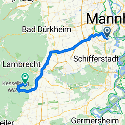
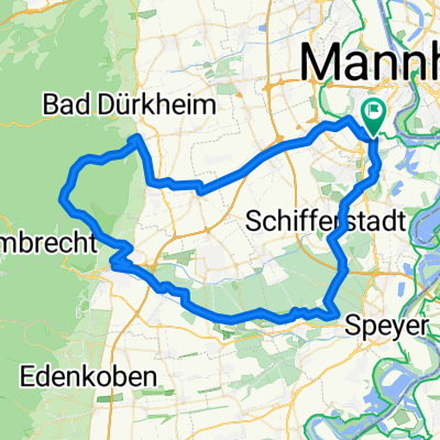
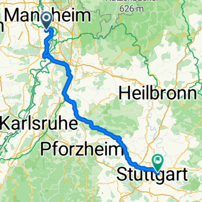
Mannheim to Stromberg Camping to Cannstatter Wason Stuttgart
A cycling route starting in Neuhofen, Rhineland-Palatinate, Germany.
Overview
About this route
- -:--
- Duration
- 116.3 km
- Distance
- 475 m
- Ascent
- 349 m
- Descent
- ---
- Avg. speed
- ---
- Max. altitude

Route quality
Waytypes & surfaces along the route
Waytypes
Track
39.5 km
(34 %)
Quiet road
29.1 km
(25 %)
Surfaces
Paved
98.8 km
(85 %)
Unpaved
9.3 km
(8 %)
Asphalt
90.7 km
(78 %)
Gravel
5.8 km
(5 %)
Continue with Bikemap
Use, edit, or download this cycling route
You would like to ride Mannheim to Stromberg Camping to Cannstatter Wason Stuttgart or customize it for your own trip? Here is what you can do with this Bikemap route:
Free features
- Save this route as favorite or in collections
- Copy & plan your own version of this route
- Split it into stages to create a multi-day tour
- Sync your route with Garmin or Wahoo
Premium features
Free trial for 3 days, or one-time payment. More about Bikemap Premium.
- Navigate this route on iOS & Android
- Export a GPX / KML file of this route
- Create your custom printout (try it for free)
- Download this route for offline navigation
Discover more Premium features.
Get Bikemap PremiumFrom our community
Other popular routes starting in Neuhofen
 Kalmithaus
- Distance
- 46.7 km
- Ascent
- 890 m
- Descent
- 330 m
- Location
- Neuhofen, Rhineland-Palatinate, Germany
 LU-Rotsteig-R58-LU
- Distance
- 79 km
- Ascent
- 609 m
- Descent
- 602 m
- Location
- Neuhofen, Rhineland-Palatinate, Germany
 LU-Rotsteig-R58-LU CLONED FROM ROUTE 171551
- Distance
- 79.2 km
- Ascent
- 245 m
- Descent
- 243 m
- Location
- Neuhofen, Rhineland-Palatinate, Germany
 Eichelgarten 26, Neuhofen nach Jahnstraße 20, Neuhofen
- Distance
- 23.5 km
- Ascent
- 73 m
- Descent
- 65 m
- Location
- Neuhofen, Rhineland-Palatinate, Germany
 Strandbadweg 1, Mannheim nach Chemin des Mouettes, Lauterbourg
- Distance
- 81.2 km
- Ascent
- 328 m
- Descent
- 306 m
- Location
- Neuhofen, Rhineland-Palatinate, Germany
 LU-rheingönheim-Altrip-MA-Rheinpromenade-LU-Parkinsel-LU-Rheingönheim
- Distance
- 25.6 km
- Ascent
- 78 m
- Descent
- 75 m
- Location
- Neuhofen, Rhineland-Palatinate, Germany
 Eisdiele Waldsee
- Distance
- 6.4 km
- Ascent
- 23 m
- Descent
- 17 m
- Location
- Neuhofen, Rhineland-Palatinate, Germany
 Bingen am Rhein - Sankt Leon-Rot
- Distance
- 129.4 km
- Ascent
- 992 m
- Descent
- 863 m
- Location
- Neuhofen, Rhineland-Palatinate, Germany
Open it in the app