

Jakobsweg per Rad (Potsdam - Santiago) Teil 09
- 72 km
- 276 m
- 457 m
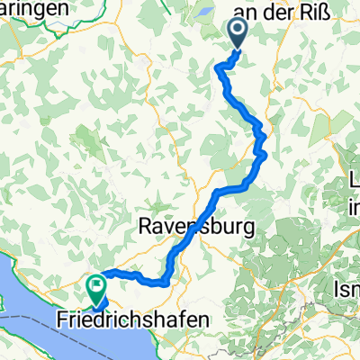
- Ingoldingen, Baden-Wurttemberg, Germany
A cycling route starting in Ingoldingen, Baden-Wurttemberg, Germany.
Overview
Camping Schwarzfelder Hof
Further along the Danube to Dillingen 110 km
created this 8 years ago
Route quality
Path
25.7 km
(34 %)
Track
18.1 km
(24 %)
Paved
67.2 km
(89 %)
Unpaved
3.8 km
(5 %)
Asphalt
66.4 km
(88 %)
Gravel
3.8 km
(5 %)
Continue with Bikemap
You would like to ride Benken Berlin Etappe 3 or customize it for your own trip? Here is what you can do with this Bikemap route:
Free trial for 3 days, or one-time payment. More about Bikemap Premium.
Discover more Premium features.
Get Bikemap PremiumFrom our community
Open it in the app


