

Um das hintere Sonnwendjoch
A cycling route starting in Langkampfen, Tyrol, Austria.
Overview
About this route
Route idea over the Thalerjoch. Including a push and carry section. Alternatively, along the ridge and mountain path to Schmalegger Joch, then descending via forest road to EHJ Klause.
- -:--
- Duration
- 46.5 km
- Distance
- 1,469 m
- Ascent
- 1,471 m
- Descent
- ---
- Avg. speed
- ---
- Max. altitude

Continue with Bikemap
Use, edit, or download this cycling route
You would like to ride Um das hintere Sonnwendjoch or customize it for your own trip? Here is what you can do with this Bikemap route:
Free features
- Save this route as favorite or in collections
- Copy & plan your own version of this route
- Sync your route with Garmin or Wahoo
Premium features
Free trial for 3 days, or one-time payment. More about Bikemap Premium.
- Navigate this route on iOS & Android
- Export a GPX / KML file of this route
- Create your custom printout (try it for free)
- Download this route for offline navigation
Discover more Premium features.
Get Bikemap PremiumFrom our community
Other popular routes starting in Langkampfen
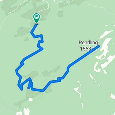 Von Thiersee über die Kala Alm zum Pendlinghaus am Gipfel des Pendling, dem Hausberg Kufsteins
- Distance
- 11.2 km
- Ascent
- 625 m
- Descent
- 625 m
- Location
- Langkampfen, Tyrol, Austria
 Langkampfen - Hohe Salve - Angath
- Distance
- 43.3 km
- Ascent
- 1,369 m
- Descent
- 1,410 m
- Location
- Langkampfen, Tyrol, Austria
 Tirolo 1
- Distance
- 59.8 km
- Ascent
- 1,010 m
- Descent
- 1,005 m
- Location
- Langkampfen, Tyrol, Austria
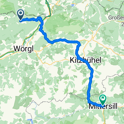 Langkampfen - Mittersill
- Distance
- 76.5 km
- Ascent
- 746 m
- Descent
- 798 m
- Location
- Langkampfen, Tyrol, Austria
 Pendling Runde CLONED FROM ROUTE 185370
- Distance
- 18.6 km
- Ascent
- 658 m
- Descent
- 722 m
- Location
- Langkampfen, Tyrol, Austria
 Schneeberg-Pendling
- Distance
- 5.8 km
- Ascent
- 745 m
- Descent
- 206 m
- Location
- Langkampfen, Tyrol, Austria
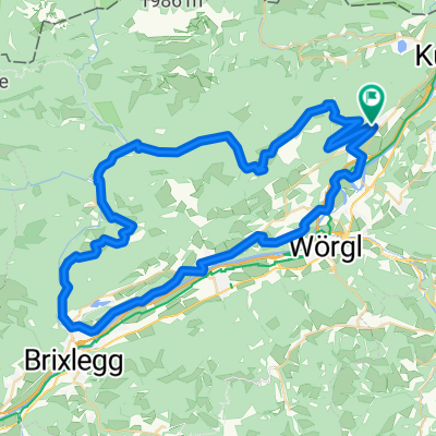 Langkampfen - Kramsach
- Distance
- 66.4 km
- Ascent
- 1,556 m
- Descent
- 1,556 m
- Location
- Langkampfen, Tyrol, Austria
 Hinterthiersee, Winterwandern und Rodeln
- Distance
- 6.8 km
- Ascent
- 332 m
- Descent
- 330 m
- Location
- Langkampfen, Tyrol, Austria
Open it in the app