

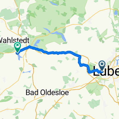
Stodo-Kesdorf-Haffkrug-HL
A cycling route starting in Stockelsdorf, Schleswig-Holstein, Germany.
Overview
About this route
- -:--
- Duration
- 77.6 km
- Distance
- 188 m
- Ascent
- 199 m
- Descent
- ---
- Avg. speed
- ---
- Max. altitude

Route quality
Waytypes & surfaces along the route
Waytypes
Quiet road
24 km
(31 %)
Road
17.8 km
(23 %)
Surfaces
Paved
62.8 km
(81 %)
Unpaved
0.8 km
(1 %)
Asphalt
52.7 km
(68 %)
Paved (undefined)
10.1 km
(13 %)
Continue with Bikemap
Use, edit, or download this cycling route
You would like to ride Stodo-Kesdorf-Haffkrug-HL or customize it for your own trip? Here is what you can do with this Bikemap route:
Free features
- Save this route as favorite or in collections
- Copy & plan your own version of this route
- Sync your route with Garmin or Wahoo
Premium features
Free trial for 3 days, or one-time payment. More about Bikemap Premium.
- Navigate this route on iOS & Android
- Export a GPX / KML file of this route
- Create your custom printout (try it for free)
- Download this route for offline navigation
Discover more Premium features.
Get Bikemap PremiumFrom our community
Other popular routes starting in Stockelsdorf
 StoDo-Süsel-Curau-StoDo
- Distance
- 61 km
- Ascent
- 182 m
- Descent
- 183 m
- Location
- Stockelsdorf, Schleswig-Holstein, Germany
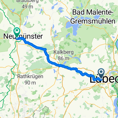
 Von Lübeck bis Wittenborn
- Distance
- 34.5 km
- Ascent
- 165 m
- Descent
- 161 m
- Location
- Stockelsdorf, Schleswig-Holstein, Germany
 Von Stodo um den Plöner See
- Distance
- 135.5 km
- Ascent
- 236 m
- Descent
- 241 m
- Location
- Stockelsdorf, Schleswig-Holstein, Germany
 Zum Bauernhof-Eiscafe Steffens
- Distance
- 38.1 km
- Ascent
- 214 m
- Descent
- 214 m
- Location
- Stockelsdorf, Schleswig-Holstein, Germany
 Steinrader Damm, Lübeck nach Gartenweg, Wasbek
- Distance
- 61.5 km
- Ascent
- 177 m
- Descent
- 176 m
- Location
- Stockelsdorf, Schleswig-Holstein, Germany
 westlich Stockelsdorf
- Distance
- 43.4 km
- Ascent
- 167 m
- Descent
- 165 m
- Location
- Stockelsdorf, Schleswig-Holstein, Germany
 Bikemap Tour am 11.05.2025 Richtung Reinfeld-
- Distance
- 36 km
- Ascent
- 95 m
- Descent
- 97 m
- Location
- Stockelsdorf, Schleswig-Holstein, Germany
 Zarpen-Neuengörs-Eilsdorf
- Distance
- 74 km
- Ascent
- 222 m
- Descent
- 230 m
- Location
- Stockelsdorf, Schleswig-Holstein, Germany
Open it in the app