

Coal Mining South of the Saar - 16 Tower Tour
A cycling route starting in Saarbrücken, Saarland, Germany.
Overview
About this route
Mine head towers Schoeneck (1) Forbach (2) Petite-Rosselle (4) St Charles - Petite-Rosselle (1) Großrosseln (1) Merlebach Nord (1) Warndt (1) Freyming-Merlebach (2) Schacht Sainte-Fontaine St Avoid (1) Velsen (1) Delbrück II Schacht in Klarenthal (1)
- -:--
- Duration
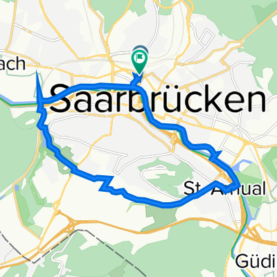
- 61.8 km
- Distance
- 582 m
- Ascent
- 581 m
- Descent
- ---
- Avg. speed
- ---
- Max. altitude

Route photos


Route highlights
Points of interest along the route

Photo after 5 km
Schoeneck

Photo after 6.7 km
Forbach

Photo after 11.5 km
Petite-Rosselle

Photo after 12.2 km
Petite-Rosselle

Photo after 14 km
St. Charles Petite-Rosselle

Photo after 18.3 km
Großrosseln

Photo after 21.4 km
Warndt

Photo after 22.9 km
Merlebach Nord

Photo after 28.6 km
Freyming-Merlebach

Photo after 30.2 km
Schacht Sainte-Fontaine St Avoid

Photo after 32.9 km
Sand cliffs

Photo after 35.1 km
Sand mine

Photo after 46 km
Velsen

Photo after 53.4 km
Delbrück II Schacht in Klarenthal
Continue with Bikemap
Use, edit, or download this cycling route
You would like to ride Coal Mining South of the Saar - 16 Tower Tour or customize it for your own trip? Here is what you can do with this Bikemap route:
Free features
- Save this route as favorite or in collections
- Copy & plan your own version of this route
- Sync your route with Garmin or Wahoo
Premium features
Free trial for 3 days, or one-time payment. More about Bikemap Premium.
- Navigate this route on iOS & Android
- Export a GPX / KML file of this route
- Create your custom printout (try it for free)
- Download this route for offline navigation
Discover more Premium features.
Get Bikemap PremiumFrom our community
Other popular routes starting in Saarbrücken
 Saarbrücken-Lorentzen-Saarbrücken
- Distance
- 115.6 km
- Ascent
- 978 m
- Descent
- 975 m
- Location
- Saarbrücken, Saarland, Germany
 Deutschland - Portugal (Berlin - Faro) FR 01 Saarbrücken - Sarre-Union
- Distance
- 57.1 km
- Ascent
- 104 m
- Descent
- 128 m
- Location
- Saarbrücken, Saarland, Germany
 Sarrebruck à pieds
- Distance
- 14.8 km
- Ascent
- 72 m
- Descent
- 72 m
- Location
- Saarbrücken, Saarland, Germany
 Saarbrücker Radler-Runde
- Distance
- 13.2 km
- Ascent
- 71 m
- Descent
- 75 m
- Location
- Saarbrücken, Saarland, Germany
 Längere Feierabend Runde
- Distance
- 61 km
- Ascent
- 540 m
- Descent
- 535 m
- Location
- Saarbrücken, Saarland, Germany
 RTF 16. Jumelage Moselle-Saar 2008 RV Blitz Saarbrücken 1897 e.V. 83 km
- Distance
- 78.6 km
- Ascent
- 855 m
- Descent
- 900 m
- Location
- Saarbrücken, Saarland, Germany
 Strasbourg
- Distance
- 123.7 km
- Ascent
- 243 m
- Descent
- 316 m
- Location
- Saarbrücken, Saarland, Germany
 Bliesgau Tour
- Distance
- 72.9 km
- Ascent
- 426 m
- Descent
- 429 m
- Location
- Saarbrücken, Saarland, Germany
Open it in the app