
4. den A
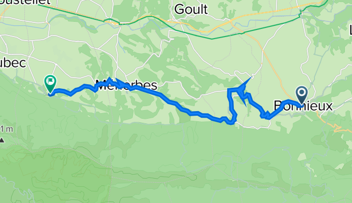
A cycling route starting in Bonnieux, Provence-Alpes-Côte d'Azur Region, France.
Overview
About this route
Bonnieux, Lacoste, Ménerbes, Oppéde le Vieux
- -:--
- Duration
- 18.1 km
- Distance
- 293 m
- Ascent
- 402 m
- Descent
- ---
- Avg. speed
- ---
- Max. altitude

Route quality
Waytypes & surfaces along the route
Waytypes
Road
12.5 km
(69 %)
Quiet road
4.5 km
(25 %)
Surfaces
Paved
5.8 km
(32 %)
Unpaved
0.4 km
(2 %)
Asphalt
5.8 km
(32 %)
Gravel
0.4 km
(2 %)
Undefined
12 km
(66 %)
Continue with Bikemap
Use, edit, or download this cycling route
You would like to ride 4. den A or customize it for your own trip? Here is what you can do with this Bikemap route:
Free features
- Save this route as favorite or in collections
- Copy & plan your own version of this route
- Sync your route with Garmin or Wahoo
Premium features
Free trial for 3 days, or one-time payment. More about Bikemap Premium.
- Navigate this route on iOS & Android
- Export a GPX / KML file of this route
- Create your custom printout (try it for free)
- Download this route for offline navigation
Discover more Premium features.
Get Bikemap PremiumFrom our community
Other popular routes starting in Bonnieux
 Bonnieux cercle 31 km
- Distance
- 31.1 km
- Ascent
- 435 m
- Descent
- 441 m
- Location
- Bonnieux, Provence-Alpes-Côte d'Azur Region, France
 De 3 Rue Droite, Bonnieux à 227 Rue de la République, Goult
- Distance
- 36.2 km
- Ascent
- 432 m
- Descent
- 587 m
- Location
- Bonnieux, Provence-Alpes-Côte d'Azur Region, France
 4. den A
- Distance
- 18.1 km
- Ascent
- 293 m
- Descent
- 402 m
- Location
- Bonnieux, Provence-Alpes-Côte d'Azur Region, France
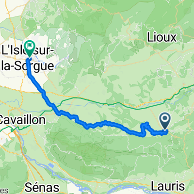
 Bonnieux - Esparron
- Distance
- 79.4 km
- Ascent
- 729 m
- Descent
- 718 m
- Location
- Bonnieux, Provence-Alpes-Côte d'Azur Region, France
 J5D RC2 MIPIM 2018
- Distance
- 29.5 km
- Ascent
- 108 m
- Descent
- 345 m
- Location
- Bonnieux, Provence-Alpes-Côte d'Azur Region, France
 Bonnieux_Lacoste_provance
- Distance
- 54.9 km
- Ascent
- 839 m
- Descent
- 844 m
- Location
- Bonnieux, Provence-Alpes-Côte d'Azur Region, France
 R-20170927-France-07
- Distance
- 35.7 km
- Ascent
- 259 m
- Descent
- 543 m
- Location
- Bonnieux, Provence-Alpes-Côte d'Azur Region, France
 Bonnieux_Lacoste
- Distance
- 54.3 km
- Ascent
- 847 m
- Descent
- 876 m
- Location
- Bonnieux, Provence-Alpes-Côte d'Azur Region, France
Open it in the app