
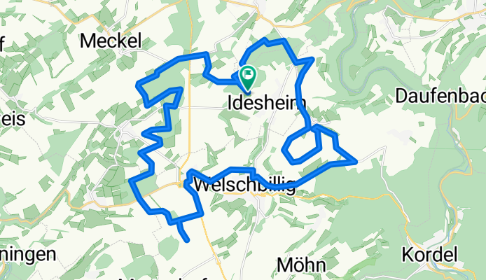
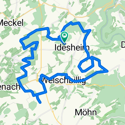
Rundweg: Aussichtspunkttour (3 Täler)
A cycling route starting in Idesheim, Rhineland-Palatinate, Germany.
Overview
About this route
In erster Linie ein Feierabend-Tour für Cross-Biker mit schönen Ausblicken (sofern man Windräder mag).
- -:--
- Duration
- 30.5 km
- Distance
- 342 m
- Ascent
- 342 m
- Descent
- ---
- Avg. speed
- ---
- Max. altitude
Route highlights
Points of interest along the route
Point of interest after 3.9 km
Blick ins Nimstal
Point of interest after 12.7 km
Blick ins Sauertal (beim Windrad)
Point of interest after 23.4 km
Blick über Kyll-/Moseltal bis zum Hunsrück
Point of interest after 26.7 km
Blick ins Kylltal
Continue with Bikemap
Use, edit, or download this cycling route
You would like to ride Rundweg: Aussichtspunkttour (3 Täler) or customize it for your own trip? Here is what you can do with this Bikemap route:
Free features
- Save this route as favorite or in collections
- Copy & plan your own version of this route
- Sync your route with Garmin or Wahoo
Premium features
Free trial for 3 days, or one-time payment. More about Bikemap Premium.
- Navigate this route on iOS & Android
- Export a GPX / KML file of this route
- Create your custom printout (try it for free)
- Download this route for offline navigation
Discover more Premium features.
Get Bikemap PremiumFrom our community
Other popular routes starting in Idesheim
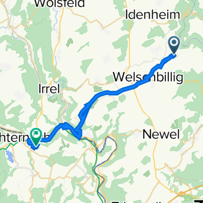 Sportliche Route in
- Distance
- 21.2 km
- Ascent
- 387 m
- Descent
- 453 m
- Location
- Idesheim, Rhineland-Palatinate, Germany
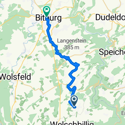 Langsame Fahrt in Bitburg
- Distance
- 18.2 km
- Ascent
- 216 m
- Descent
- 198 m
- Location
- Idesheim, Rhineland-Palatinate, Germany
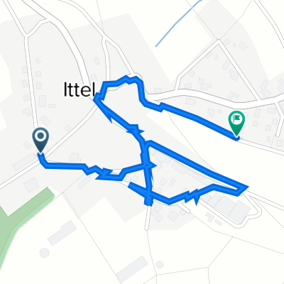
 Tour 14 h Ittel seguito tour h 4 Wie
- Distance
- 4.8 km
- Ascent
- 42 m
- Descent
- 192 m
- Location
- Idesheim, Rhineland-Palatinate, Germany
 Tour 14 h Ittel 5 Wie
- Distance
- 1.7 km
- Ascent
- 22 m
- Descent
- 51 m
- Location
- Idesheim, Rhineland-Palatinate, Germany
 Rundweg: Aussichtspunkttour (3 Täler)
- Distance
- 30.5 km
- Ascent
- 342 m
- Descent
- 342 m
- Location
- Idesheim, Rhineland-Palatinate, Germany
 Recovered Route
- Distance
- 67.1 km
- Ascent
- 699 m
- Descent
- 894 m
- Location
- Idesheim, Rhineland-Palatinate, Germany
 Im Schall 11, Welschbillig nach Im Schall 11, Welschbillig
- Distance
- 7.6 km
- Ascent
- 73 m
- Descent
- 65 m
- Location
- Idesheim, Rhineland-Palatinate, Germany
 Idesheim-Minden-Dockendorf-Meckel-Idesheim
- Distance
- 48.4 km
- Ascent
- 604 m
- Descent
- 604 m
- Location
- Idesheim, Rhineland-Palatinate, Germany
Open it in the app