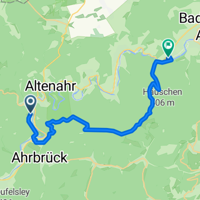
2. Vorschlag für Bitburg-A-Gruppe 2017
A cycling route starting in Altenahr, Rhineland-Palatinate, Germany.
Overview
About this route
Challenging tour through the Eifel with a stop at the Kolvenbacher Ziegenhof
- -:--
- Duration
- 73 km
- Distance
- 974 m
- Ascent
- 968 m
- Descent
- ---
- Avg. speed
- ---
- Max. altitude
Route quality
Waytypes & surfaces along the route
Waytypes
Road
18.3 km
(25 %)
Quiet road
11 km
(15 %)
Surfaces
Paved
43.8 km
(60 %)
Unpaved
7.3 km
(10 %)
Asphalt
40.2 km
(55 %)
Paved (undefined)
3.7 km
(5 %)
Continue with Bikemap
Use, edit, or download this cycling route
You would like to ride 2. Vorschlag für Bitburg-A-Gruppe 2017 or customize it for your own trip? Here is what you can do with this Bikemap route:
Free features
- Save this route as favorite or in collections
- Copy & plan your own version of this route
- Sync your route with Garmin or Wahoo
Premium features
Free trial for 3 days, or one-time payment. More about Bikemap Premium.
- Navigate this route on iOS & Android
- Export a GPX / KML file of this route
- Create your custom printout (try it for free)
- Download this route for offline navigation
Discover more Premium features.
Get Bikemap PremiumFrom our community
Other popular routes starting in Altenahr
Altenburg - Steinerberg - Altenburg- Distance
- 24 km
- Ascent
- 906 m
- Descent
- 906 m
- Location
- Altenahr, Rhineland-Palatinate, Germany
Altenahr - Schrock - Steinerberghaus - Teufelsloch- Distance
- 16.7 km
- Ascent
- 718 m
- Descent
- 719 m
- Location
- Altenahr, Rhineland-Palatinate, Germany
Altenahr - Mönchengladbach- Distance
- 103.9 km
- Ascent
- 288 m
- Descent
- 382 m
- Location
- Altenahr, Rhineland-Palatinate, Germany
Nette Runde in die Hocheifel und zurück- Distance
- 60.7 km
- Ascent
- 691 m
- Descent
- 692 m
- Location
- Altenahr, Rhineland-Palatinate, Germany
Ahrrunde zur Hohen Acht- Distance
- 61.5 km
- Ascent
- 1,067 m
- Descent
- 951 m
- Location
- Altenahr, Rhineland-Palatinate, Germany
CYCLING THE RHINE: Route 10B(b)- Distance
- 35.9 km
- Ascent
- 84 m
- Descent
- 195 m
- Location
- Altenahr, Rhineland-Palatinate, Germany
Walporzheimer Straße, Bad Neuenahr-Ahrweiler nach Brückenstraße, Altenahr- Distance
- 15.9 km
- Ascent
- 545 m
- Descent
- 615 m
- Location
- Altenahr, Rhineland-Palatinate, Germany
Familienradtour in Coronazeiten- Distance
- 32.6 km
- Ascent
- 331 m
- Descent
- 332 m
- Location
- Altenahr, Rhineland-Palatinate, Germany
Open it in the app

