

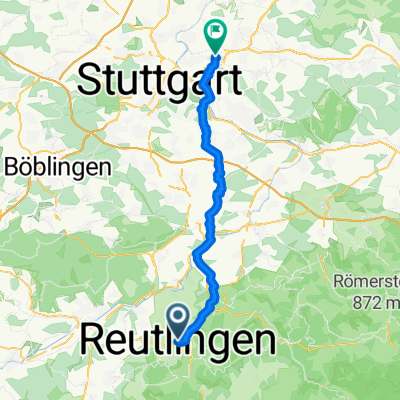
Reutlingen - St. Johann - Kohlstetten - Holzelfingen - Pfullingen - Reutlingen
A cycling route starting in Reutlingen, Baden-Wurttemberg, Germany.
Overview
About this route
Winter training loop on the Alb, Eninger Steige is mostly in the sun, making it pleasant to ride in winter. Roads are generally cleared quickly after snowfall, and outside of rush hour, there is relatively little motor vehicle traffic. The route can be shortened or extended depending on the weather or training condition.
- -:--
- Duration
- 46.9 km
- Distance
- 643 m
- Ascent
- 581 m
- Descent
- ---
- Avg. speed
- 771 m
- Max. altitude

Route quality
Waytypes & surfaces along the route
Waytypes
Quiet road
7 km
(15 %)
Track
4.2 km
(9 %)
Surfaces
Paved
45.5 km
(97 %)
Unpaved
0.9 km
(2 %)
Asphalt
44.6 km
(95 %)
Paved (undefined)
0.9 km
(2 %)
Continue with Bikemap
Use, edit, or download this cycling route
You would like to ride Reutlingen - St. Johann - Kohlstetten - Holzelfingen - Pfullingen - Reutlingen or customize it for your own trip? Here is what you can do with this Bikemap route:
Free features
- Save this route as favorite or in collections
- Copy & plan your own version of this route
- Sync your route with Garmin or Wahoo
Premium features
Free trial for 3 days, or one-time payment. More about Bikemap Premium.
- Navigate this route on iOS & Android
- Export a GPX / KML file of this route
- Create your custom printout (try it for free)
- Download this route for offline navigation
Discover more Premium features.
Get Bikemap PremiumFrom our community
Other popular routes starting in Reutlingen
 Lautertal
- Distance
- 75.8 km
- Ascent
- 952 m
- Descent
- 945 m
- Location
- Reutlingen, Baden-Wurttemberg, Germany
 Schloss Lichtenstein Tour
- Distance
- 32.1 km
- Ascent
- 468 m
- Descent
- 468 m
- Location
- Reutlingen, Baden-Wurttemberg, Germany
 RT-St.Johann-Münsingen-Hohenstein-Undingen-Gönningen-RT
- Distance
- 84.1 km
- Ascent
- 830 m
- Descent
- 832 m
- Location
- Reutlingen, Baden-Wurttemberg, Germany
 Holzgerlingen - Ebersbach an der Fils
- Distance
- 48.4 km
- Ascent
- 594 m
- Descent
- 684 m
- Location
- Reutlingen, Baden-Wurttemberg, Germany
 Reutlingen - Neckartal, Aichtal, Schönbuch, Tübingen - Reutlingen
- Distance
- 59 km
- Ascent
- 562 m
- Descent
- 597 m
- Location
- Reutlingen, Baden-Wurttemberg, Germany
 Rund um Achalm
- Distance
- 24.3 km
- Ascent
- 281 m
- Descent
- 281 m
- Location
- Reutlingen, Baden-Wurttemberg, Germany
 Reutlingen Nürtingen Wendlingen 32km 110hm
- Distance
- 32.4 km
- Ascent
- 90 m
- Descent
- 217 m
- Location
- Reutlingen, Baden-Wurttemberg, Germany
 Reutlingen - St. Johann - Kohlstetten - Holzelfingen - Pfullingen - Reutlingen
- Distance
- 46.9 km
- Ascent
- 643 m
- Descent
- 581 m
- Location
- Reutlingen, Baden-Wurttemberg, Germany
Open it in the app