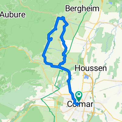
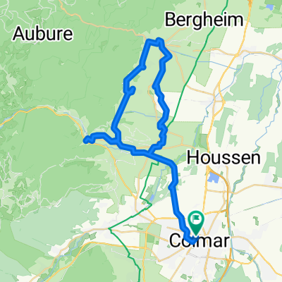
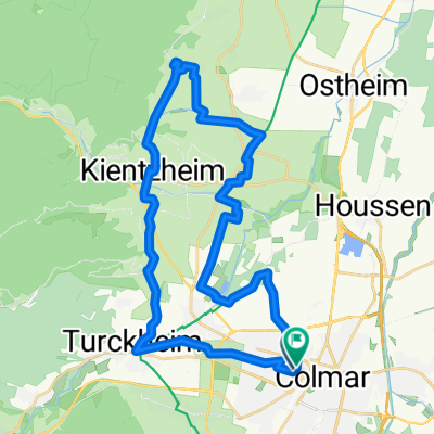
Ausfahrt vom 01.06.17, 19:09
A cycling route starting in Colmar, Grand Est, France.
Overview
About this route
- -:--
- Duration
- 18.8 km
- Distance
- 69 m
- Ascent
- 45 m
- Descent
- ---
- Avg. speed
- ---
- Max. altitude
Route quality
Waytypes & surfaces along the route
Waytypes
Track
6.8 km
(36 %)
Quiet road
5.4 km
(29 %)
Surfaces
Paved
14.7 km
(78 %)
Asphalt
7.5 km
(40 %)
Paved (undefined)
7.1 km
(38 %)
Undefined
4.1 km
(22 %)
Route highlights
Points of interest along the route
Point of interest after 9.9 km
Continue with Bikemap
Use, edit, or download this cycling route
You would like to ride Ausfahrt vom 01.06.17, 19:09 or customize it for your own trip? Here is what you can do with this Bikemap route:
Free features
- Save this route as favorite or in collections
- Copy & plan your own version of this route
- Sync your route with Garmin or Wahoo
Premium features
Free trial for 3 days, or one-time payment. More about Bikemap Premium.
- Navigate this route on iOS & Android
- Export a GPX / KML file of this route
- Create your custom printout (try it for free)
- Download this route for offline navigation
Discover more Premium features.
Get Bikemap PremiumFrom our community
Other popular routes starting in Colmar
- Etappe 14 Tour de France 2009 von Colmar nach Besançon
- Distance
- 202.5 km
- Ascent
- 1,131 m
- Descent
- 1,003 m
- Location
- Colmar, Grand Est, France
- Golmar
- Distance
- 48.2 km
- Ascent
- 684 m
- Descent
- 685 m
- Location
- Colmar, Grand Est, France
- TdF Freitag
- Distance
- 111.5 km
- Ascent
- 1,950 m
- Descent
- 1,759 m
- Location
- Colmar, Grand Est, France
- TdF 09 Colmar-Colmar
- Distance
- 155.8 km
- Ascent
- 3,542 m
- Descent
- 3,333 m
- Location
- Colmar, Grand Est, France
- COLMAR-COLMAR via KB/trois epis 50KMS
- Distance
- 48.2 km
- Ascent
- 609 m
- Descent
- 605 m
- Location
- Colmar, Grand Est, France
- PRIMA TAPPA
- Distance
- 86.1 km
- Ascent
- 1,115 m
- Descent
- 1,113 m
- Location
- Colmar, Grand Est, France
- Colmar-trois epis-c.d.Linge-c.d.Wettsein-L.Noir-L.Blanc-c.d.Calvaire-C.d.l.Schlucht-Hoheneck-Metzeral-Colmar
- Distance
- 88.2 km
- Ascent
- 1,329 m
- Descent
- 1,333 m
- Location
- Colmar, Grand Est, France
- CYCLING THE RHINE: Route R02A
- Distance
- 87.2 km
- Ascent
- 47 m
- Descent
- 105 m
- Location
- Colmar, Grand Est, France
Open it in the app