

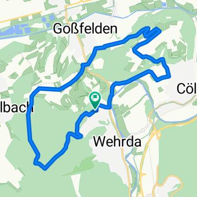
Downhillstrecke Waldtal
A cycling route starting in Cölbe, Hesse, Germany.
Overview
About this route
Streckenverlauf nach GPS-Aufzeichnung nachgezeichnet, letztes Stück Asphalt zum Ausrollen
- -:--
- Duration
- 0.5 km
- Distance
- 4 m
- Ascent
- 60 m
- Descent
- ---
- Avg. speed
- ---
- Max. altitude

Route quality
Waytypes & surfaces along the route
Waytypes
Track
0.3 km
(65 %)
Path
0.2 km
(35 %)
Surfaces
Paved
0.1 km
(17 %)
Unpaved
0.2 km
(49 %)
Gravel
0.2 km
(49 %)
Asphalt
0.1 km
(17 %)
Undefined
0.2 km
(34 %)
Continue with Bikemap
Use, edit, or download this cycling route
You would like to ride Downhillstrecke Waldtal or customize it for your own trip? Here is what you can do with this Bikemap route:
Free features
- Save this route as favorite or in collections
- Copy & plan your own version of this route
- Sync your route with Garmin or Wahoo
Premium features
Free trial for 3 days, or one-time payment. More about Bikemap Premium.
- Navigate this route on iOS & Android
- Export a GPX / KML file of this route
- Create your custom printout (try it for free)
- Download this route for offline navigation
Discover more Premium features.
Get Bikemap PremiumFrom our community
Other popular routes starting in Cölbe
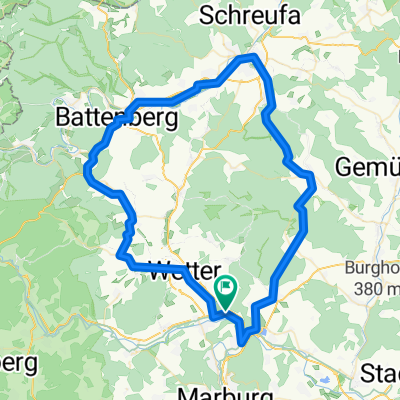
 lahntal gladenbach
- Distance
- 76.6 km
- Ascent
- 498 m
- Descent
- 496 m
- Location
- Cölbe, Hesse, Germany
 Teil 2 Zabakuck
- Distance
- 85.5 km
- Ascent
- 0 m
- Descent
- 0 m
- Location
- Cölbe, Hesse, Germany
 Frauenbergrunde
- Distance
- 39 km
- Ascent
- 565 m
- Descent
- 565 m
- Location
- Cölbe, Hesse, Germany
 Lahntal Edersee
- Distance
- 129 km
- Ascent
- 934 m
- Descent
- 936 m
- Location
- Cölbe, Hesse, Germany
 2004 Mühle-Schweinsberg
- Distance
- 17.2 km
- Ascent
- 19 m
- Descent
- 12 m
- Location
- Cölbe, Hesse, Germany
 14k tour
- Distance
- 14 km
- Ascent
- 277 m
- Descent
- 277 m
- Location
- Cölbe, Hesse, Germany
 Mönchswald ab Sarnau
- Distance
- 76 km
- Ascent
- 539 m
- Descent
- 536 m
- Location
- Cölbe, Hesse, Germany
 Frankenberg-Rosenthal
- Distance
- 59.3 km
- Ascent
- 551 m
- Descent
- 551 m
- Location
- Cölbe, Hesse, Germany
Open it in the app