

yeuhfuehwui
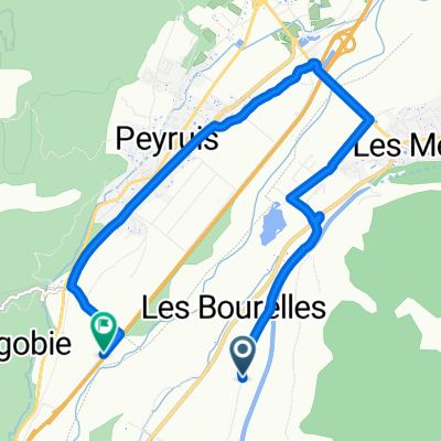
A cycling route starting in Peyruis, Provence-Alpes-Côte d'Azur Region, France.
Overview
About this route
- -:--
- Duration
- 280.9 km
- Distance
- 3,713 m
- Ascent
- 2,977 m
- Descent
- ---
- Avg. speed
- ---
- Max. altitude

Route quality
Waytypes & surfaces along the route
Waytypes
Road
146.1 km
(52 %)
Quiet road
39.3 km
(14 %)
Surfaces
Paved
199.5 km
(71 %)
Unpaved
14 km
(5 %)
Asphalt
199.5 km
(71 %)
Unpaved (undefined)
5.6 km
(2 %)
Continue with Bikemap
Use, edit, or download this cycling route
You would like to ride yeuhfuehwui or customize it for your own trip? Here is what you can do with this Bikemap route:
Free features
- Save this route as favorite or in collections
- Copy & plan your own version of this route
- Split it into stages to create a multi-day tour
- Sync your route with Garmin or Wahoo
Premium features
Free trial for 3 days, or one-time payment. More about Bikemap Premium.
- Navigate this route on iOS & Android
- Export a GPX / KML file of this route
- Create your custom printout (try it for free)
- Download this route for offline navigation
Discover more Premium features.
Get Bikemap PremiumFrom our community
Other popular routes starting in Peyruis
 D 101, Mallefougasse-Augès to 2–8 Place Elie Castel Maire de Mezel, Mézel
- Distance
- 35.4 km
- Ascent
- 521 m
- Descent
- 604 m
- Location
- Peyruis, Provence-Alpes-Côte d'Azur Region, France
 Cruis-Font Belle-Bonnet-Cruis
- Distance
- 116.5 km
- Ascent
- 1,632 m
- Descent
- 1,631 m
- Location
- Peyruis, Provence-Alpes-Côte d'Azur Region, France
 Limans-Fontienne 50 600
- Distance
- 52.5 km
- Ascent
- 554 m
- Descent
- 576 m
- Location
- Peyruis, Provence-Alpes-Côte d'Azur Region, France
 montagne de Lure
- Distance
- 78.1 km
- Ascent
- 1,326 m
- Descent
- 1,327 m
- Location
- Peyruis, Provence-Alpes-Côte d'Azur Region, France
 yeuhfuehwui
- Distance
- 280.9 km
- Ascent
- 3,713 m
- Descent
- 2,977 m
- Location
- Peyruis, Provence-Alpes-Côte d'Azur Region, France
 Ganagobie
- Distance
- 11.6 km
- Ascent
- 307 m
- Descent
- 307 m
- Location
- Peyruis, Provence-Alpes-Côte d'Azur Region, France
 Cruis-Gorges de Verdon-Gruis
- Distance
- 214 km
- Ascent
- 2,201 m
- Descent
- 2,203 m
- Location
- Peyruis, Provence-Alpes-Côte d'Azur Region, France
 Route des Plaines, Les Mées to Autoroute du Val de Durance, Ganagobie
- Distance
- 10.2 km
- Ascent
- 18 m
- Descent
- 60 m
- Location
- Peyruis, Provence-Alpes-Côte d'Azur Region, France
Open it in the app