

RTTR
Find the Gnomes from Rubber to the Road
A cycling route starting in Portland, Oregon, United States.
Overview
About this route
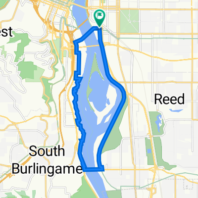
Up Cornell, 53rd, and Thompson, over Skyline and down Thompson, Laidlaw and across Kaiser to (Old) Germantown. Up and over to the St. John's Bridge, across Willamette back to the Adidas campus/Madrona Park area.
- -:--
- Duration
- 46.3 km
- Distance
- 696 m
- Ascent
- 695 m
- Descent
- ---
- Avg. speed
- ---
- Max. altitude

Part of
RTTR
1 stage
Route quality
Waytypes & surfaces along the route
Waytypes
Busy road
17.3 km
(37 %)
Quiet road
12.2 km
(26 %)
Surfaces
Paved
30.7 km
(66 %)
Unpaved
0.2 km
(<1 %)
Asphalt
27.7 km
(60 %)
Paved (undefined)
1.8 km
(4 %)
Continue with Bikemap
Use, edit, or download this cycling route
You would like to ride Find the Gnomes from Rubber to the Road or customize it for your own trip? Here is what you can do with this Bikemap route:
Free features
- Save this route as favorite or in collections
- Copy & plan your own version of this route
- Sync your route with Garmin or Wahoo
Premium features
Free trial for 3 days, or one-time payment. More about Bikemap Premium.
- Navigate this route on iOS & Android
- Export a GPX / KML file of this route
- Create your custom printout (try it for free)
- Download this route for offline navigation
Discover more Premium features.
Get Bikemap PremiumFrom our community
Other popular routes starting in Portland
 Kelley point FLAT route
- Distance
- 39.3 km
- Ascent
- 39 m
- Descent
- 101 m
- Location
- Portland, Oregon, United States
 Loop from Home to Columbia River and Around River
- Distance
- 39.3 km
- Ascent
- 160 m
- Descent
- 194 m
- Location
- Portland, Oregon, United States
 8/21 ride4 fun
- Distance
- 19.6 km
- Ascent
- 85 m
- Descent
- 83 m
- Location
- Portland, Oregon, United States
 Willamette Greenway, Portland to Willamette Greenway, Portland
- Distance
- 17.2 km
- Ascent
- 73 m
- Descent
- 74 m
- Location
- Portland, Oregon, United States
 Oswego Loop
- Distance
- 48.1 km
- Ascent
- 320 m
- Descent
- 325 m
- Location
- Portland, Oregon, United States
 Sellwood Bridge Loop
- Distance
- 12.2 km
- Ascent
- 90 m
- Descent
- 87 m
- Location
- Portland, Oregon, United States
 Find the Gnomes from Rubber to the Road
- Distance
- 46.3 km
- Ascent
- 696 m
- Descent
- 695 m
- Location
- Portland, Oregon, United States
 Large bridge loop
- Distance
- 17.3 km
- Ascent
- 110 m
- Descent
- 124 m
- Location
- Portland, Oregon, United States
Open it in the app