

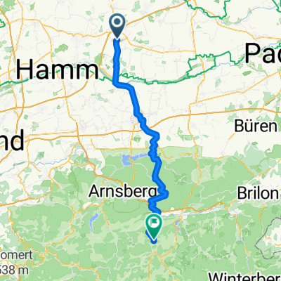
Beckum-Werse-Uentrup-Schloss Werries-Ahlen-Beckum
A cycling route starting in Beckum, North Rhine-Westphalia, Germany.
Overview
About this route
Leichte, sehr schöne Strecke, abwechslungsreich
- -:--
- Duration
- 50.4 km
- Distance
- 114 m
- Ascent
- 122 m
- Descent
- ---
- Avg. speed
- 114 m
- Max. altitude

Route quality
Waytypes & surfaces along the route
Waytypes
Cycleway
17.1 km
(34 %)
Quiet road
15.5 km
(31 %)
Surfaces
Paved
28.1 km
(56 %)
Unpaved
16.3 km
(32 %)
Asphalt
22.9 km
(45 %)
Loose gravel
13.8 km
(27 %)
Continue with Bikemap
Use, edit, or download this cycling route
You would like to ride Beckum-Werse-Uentrup-Schloss Werries-Ahlen-Beckum or customize it for your own trip? Here is what you can do with this Bikemap route:
Free features
- Save this route as favorite or in collections
- Copy & plan your own version of this route
- Sync your route with Garmin or Wahoo
Premium features
Free trial for 3 days, or one-time payment. More about Bikemap Premium.
- Navigate this route on iOS & Android
- Export a GPX / KML file of this route
- Create your custom printout (try it for free)
- Download this route for offline navigation
Discover more Premium features.
Get Bikemap PremiumFrom our community
Other popular routes starting in Beckum
 Beckum-Werse-Uentrup-Schloss Werries-Ahlen-Beckum
- Distance
- 50.4 km
- Ascent
- 114 m
- Descent
- 122 m
- Location
- Beckum, North Rhine-Westphalia, Germany
 Beckum-Westladbergen Saerbeck
- Distance
- 86.6 km
- Ascent
- 45 m
- Descent
- 125 m
- Location
- Beckum, North Rhine-Westphalia, Germany
 Höxberg, Onkhausberg, Diestedder und Mackenberg
- Distance
- 39.3 km
- Ascent
- 277 m
- Descent
- 277 m
- Location
- Beckum, North Rhine-Westphalia, Germany
 Zum-Butterschlot
- Distance
- 19 km
- Ascent
- 74 m
- Descent
- 98 m
- Location
- Beckum, North Rhine-Westphalia, Germany
 Beckum-Wenholthausen/Eslohe
- Distance
- 74.7 km
- Ascent
- 928 m
- Descent
- 766 m
- Location
- Beckum, North Rhine-Westphalia, Germany
 Beckumer Werseradtour 1
- Distance
- 41 km
- Ascent
- 164 m
- Descent
- 148 m
- Location
- Beckum, North Rhine-Westphalia, Germany
 Beckumer Werseradtour 1
- Distance
- 41 km
- Ascent
- 156 m
- Descent
- 156 m
- Location
- Beckum, North Rhine-Westphalia, Germany
 Von Beckum bis Bad Homburg vor der Höhe
- Distance
- 272.2 km
- Ascent
- 3,098 m
- Descent
- 3,067 m
- Location
- Beckum, North Rhine-Westphalia, Germany
Open it in the app