

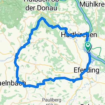
🚴♀️E*Bike🇦🇹Aufwärmrunde
A cycling route starting in Feldkirchen an der Donau, Upper Austria, Austria.
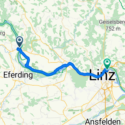
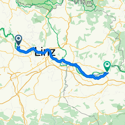
Overview
About this route
Cycling route R1 and R 18 parking option. Coordinates 48.338519,13.999601 Pupping - Aschach - Feldkirchen an der Donau - R 1 - to the Ottensheim power plant - over the DANUBE - Alkoven - Aham - Inn - Raffeldin - Fraham - Hinzenbach - Seebach - PUPPING. Coordinates 48.338500, 13.999695 DESTINATION.
- -:--
- Duration
- 47.4 km
- Distance
- 51 m
- Ascent
- 50 m
- Descent
- ---
- Avg. speed
- ---
- Max. altitude

Route photos


Route quality
Waytypes & surfaces along the route
Waytypes
Quiet road
31.7 km
(67 %)
Cycleway
5.2 km
(11 %)
Surfaces
Paved
16.1 km
(34 %)
Unpaved
3.8 km
(8 %)
Asphalt
15.6 km
(33 %)
Gravel
3.8 km
(8 %)
Route highlights
Points of interest along the route
Point of interest after 0 km
Koordinaten 48.338519, 13.999601
Continue with Bikemap
Use, edit, or download this cycling route
You would like to ride 🚴♀️E*Bike🇦🇹Aufwärmrunde or customize it for your own trip? Here is what you can do with this Bikemap route:
Free features
- Save this route as favorite or in collections
- Copy & plan your own version of this route
- Sync your route with Garmin or Wahoo
Premium features
Free trial for 3 days, or one-time payment. More about Bikemap Premium.
- Navigate this route on iOS & Android
- Export a GPX / KML file of this route
- Create your custom printout (try it for free)
- Download this route for offline navigation
Discover more Premium features.
Get Bikemap PremiumFrom our community
Other popular routes starting in Feldkirchen an der Donau
 D03 Eferding to Mauthausen
- Distance
- 55 km
- Ascent
- 169 m
- Descent
- 197 m
- Location
- Feldkirchen an der Donau, Upper Austria, Austria
 Brandstatt nach Brandstatt
- Distance
- 48.5 km
- Ascent
- 715 m
- Descent
- 717 m
- Location
- Feldkirchen an der Donau, Upper Austria, Austria
 Donauradweg - Aschachtal - Runde
- Distance
- 72.7 km
- Ascent
- 1,725 m
- Descent
- 1,725 m
- Location
- Feldkirchen an der Donau, Upper Austria, Austria
 Feldkirchen an der Donau - Enns
- Distance
- 51.5 km
- Ascent
- 75 m
- Descent
- 130 m
- Location
- Feldkirchen an der Donau, Upper Austria, Austria
 Donausteig Passau-Linz-St Nikola, Aschach an der Donau - Am Winterhafen, Linz
- Distance
- 30.6 km
- Ascent
- 58 m
- Descent
- 70 m
- Location
- Feldkirchen an der Donau, Upper Austria, Austria
 🚴♀️E*Bike🇦🇹Aufwärmrunde
- Distance
- 47.4 km
- Ascent
- 51 m
- Descent
- 50 m
- Location
- Feldkirchen an der Donau, Upper Austria, Austria
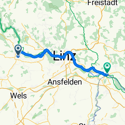
 D02 Aschach-Linz
- Distance
- 28.7 km
- Ascent
- 99 m
- Descent
- 111 m
- Location
- Feldkirchen an der Donau, Upper Austria, Austria
 Feldkirchen an der Donau - Amstetten
- Distance
- 81.4 km
- Ascent
- 197 m
- Descent
- 231 m
- Location
- Feldkirchen an der Donau, Upper Austria, Austria
Open it in the app