

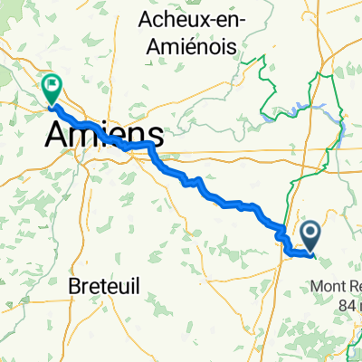
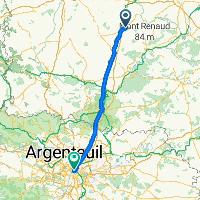
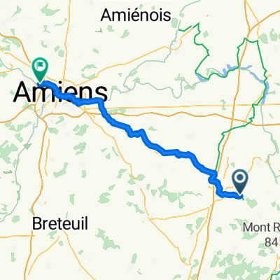
Recording from 3 juin 2017 à 20:23
A cycling route starting in Roye, Hauts-de-France, France.
Overview
About this route
- -:--
- Duration
- 26.1 km
- Distance
- 90 m
- Ascent
- 99 m
- Descent
- ---
- Avg. speed
- ---
- Max. altitude

Continue with Bikemap
Use, edit, or download this cycling route
You would like to ride Recording from 3 juin 2017 à 20:23 or customize it for your own trip? Here is what you can do with this Bikemap route:
Free features
- Save this route as favorite or in collections
- Copy & plan your own version of this route
- Sync your route with Garmin or Wahoo
Premium features
Free trial for 3 days, or one-time payment. More about Bikemap Premium.
- Navigate this route on iOS & Android
- Export a GPX / KML file of this route
- Create your custom printout (try it for free)
- Download this route for offline navigation
Discover more Premium features.
Get Bikemap PremiumFrom our community
Other popular routes starting in Roye
 Roye - Picquigny
- Distance
- 72 km
- Ascent
- 293 m
- Descent
- 370 m
- Location
- Roye, Hauts-de-France, France
 Roye - Paris
- Distance
- 105.9 km
- Ascent
- 196 m
- Descent
- 231 m
- Location
- Roye, Hauts-de-France, France
 2- Paris- AMS J3
- Distance
- 74.1 km
- Ascent
- 182 m
- Descent
- 218 m
- Location
- Roye, Hauts-de-France, France
 4.Etappe Di. 27.07.2010 Roye -Louviers
- Distance
- 150.6 km
- Ascent
- 630 m
- Descent
- 693 m
- Location
- Roye, Hauts-de-France, France
 D 161 E, La Chavatte à 2 Rue Nicolas Cuvilly, La Chavatte
- Distance
- 16 km
- Ascent
- 38 m
- Descent
- 42 m
- Location
- Roye, Hauts-de-France, France
 13 Rue de l'Église, Damery à 3 Rue de la République, Cerisy
- Distance
- 24.1 km
- Ascent
- 51 m
- Descent
- 112 m
- Location
- Roye, Hauts-de-France, France
 Roye - Dreuil-lès-Amiens
- Distance
- 65.3 km
- Ascent
- 268 m
- Descent
- 344 m
- Location
- Roye, Hauts-de-France, France
 Route to Autoroute du Nord, Chaulnes
- Distance
- 11.3 km
- Ascent
- 35 m
- Descent
- 36 m
- Location
- Roye, Hauts-de-France, France
Open it in the app