

10 at 10
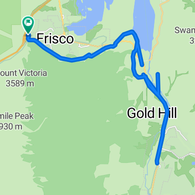
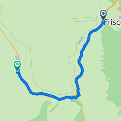
A cycling route starting in Frisco, Colorado, United States.
Overview
About this route
10 at 10 - 50 Mile rt trail run from Frisco with 10,000 feet elevation gain at an average elevation of 10,000 feet
- -:--
- Duration
- 26.2 km
- Distance
- 831 m
- Ascent
- 469 m
- Descent
- ---
- Avg. speed
- ---
- Max. altitude
Route highlights
Points of interest along the route
Point of interest after 16.7 km
Aid Station #1 - Vertical Runner 10.6 Miles 39.4 to Finish
Point of interest after 26 km
Aid Station #2 - Base of Humbug Hill 16.3 Miles 33.7 Miles from Finish
Continue with Bikemap
Use, edit, or download this cycling route
You would like to ride 10 at 10 or customize it for your own trip? Here is what you can do with this Bikemap route:
Free features
- Save this route as favorite or in collections
- Copy & plan your own version of this route
- Sync your route with Garmin or Wahoo
Premium features
Free trial for 3 days, or one-time payment. More about Bikemap Premium.
- Navigate this route on iOS & Android
- Export a GPX / KML file of this route
- Create your custom printout (try it for free)
- Download this route for offline navigation
Discover more Premium features.
Get Bikemap PremiumFrom our community
Other popular routes starting in Frisco
 Stage 3: CopperMtn to Aspen (Maroon Lake)
- Distance
- 148.6 km
- Ascent
- 1,963 m
- Descent
- 2,004 m
- Location
- Frisco, Colorado, United States
 Recovered Route
- Distance
- 11 km
- Ascent
- 70 m
- Descent
- 67 m
- Location
- Frisco, Colorado, United States
 Copper Triangle 100
- Distance
- 158.8 km
- Ascent
- 2,247 m
- Descent
- 2,044 m
- Location
- Frisco, Colorado, United States
 Forest Drive 110, Frisco to Forest Drive 110, Frisco
- Distance
- 30.6 km
- Ascent
- 173 m
- Descent
- 173 m
- Location
- Frisco, Colorado, United States
 Restful route in Denver
- Distance
- 31.1 km
- Ascent
- 376 m
- Descent
- 377 m
- Location
- Frisco, Colorado, United States
 Swan Mountain Loop
- Distance
- 45.2 km
- Ascent
- 551 m
- Descent
- 427 m
- Location
- Frisco, Colorado, United States
 208 Main St, Frisco to 23060 US-6 E, Dillon
- Distance
- 21.1 km
- Ascent
- 210 m
- Descent
- 136 m
- Location
- Frisco, Colorado, United States
 Frisco to Vail Pass
- Distance
- 18 km
- Ascent
- 453 m
- Descent
- 18 m
- Location
- Frisco, Colorado, United States
Open it in the app