Radtour 2017 31.05.
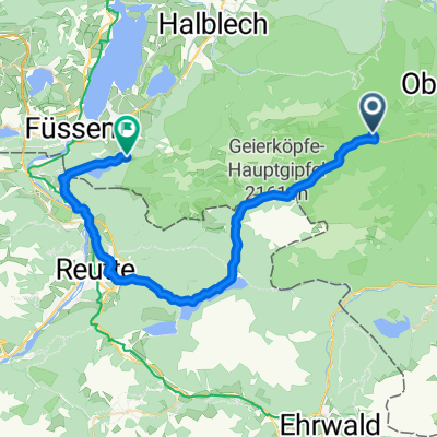
A cycling route starting in Unterammergau, Bavaria, Germany.
Overview
About this route
- -:--
- Duration
- 93.3 km
- Distance
- 548 m
- Ascent
- 584 m
- Descent
- ---
- Avg. speed
- ---
- Max. altitude
Route quality
Waytypes & surfaces along the route
Waytypes
Track
40.1 km
(43 %)
Quiet road
16.8 km
(18 %)
Surfaces
Paved
62.5 km
(67 %)
Unpaved
25.2 km
(27 %)
Asphalt
59.7 km
(64 %)
Gravel
16.8 km
(18 %)
Continue with Bikemap
Use, edit, or download this cycling route
You would like to ride Radtour 2017 31.05. or customize it for your own trip? Here is what you can do with this Bikemap route:
Free features
- Save this route as favorite or in collections
- Copy & plan your own version of this route
- Split it into stages to create a multi-day tour
- Sync your route with Garmin or Wahoo
Premium features
Free trial for 3 days, or one-time payment. More about Bikemap Premium.
- Navigate this route on iOS & Android
- Export a GPX / KML file of this route
- Create your custom printout (try it for free)
- Download this route for offline navigation
Discover more Premium features.
Get Bikemap PremiumFrom our community
Other popular routes starting in Unterammergau
- Pürschling hart aber herzlich
- Distance
- 5.4 km
- Ascent
- 700 m
- Descent
- 51 m
- Location
- Unterammergau, Bavaria, Germany
- Von Unterammergau nach Unternogg auf den Pürschling
- Distance
- 29.6 km
- Ascent
- 999 m
- Descent
- 1,000 m
- Location
- Unterammergau, Bavaria, Germany
- Linderhof Rück
- Distance
- 21.1 km
- Ascent
- 392 m
- Descent
- 588 m
- Location
- Unterammergau, Bavaria, Germany
- Um´s Hörnle
- Distance
- 30 km
- Ascent
- 780 m
- Descent
- 780 m
- Location
- Unterammergau, Bavaria, Germany
- Planseerunde
- Distance
- 47.6 km
- Ascent
- 766 m
- Descent
- 765 m
- Location
- Unterammergau, Bavaria, Germany
- Linderhof Rück Farchant
- Distance
- 31.1 km
- Ascent
- 253 m
- Descent
- 444 m
- Location
- Unterammergau, Bavaria, Germany
- Rund ums Ammergebirge
- Distance
- 108.7 km
- Ascent
- 524 m
- Descent
- 525 m
- Location
- Unterammergau, Bavaria, Germany
- Altherrenweg Ogau
- Distance
- 7.4 km
- Ascent
- 161 m
- Descent
- 160 m
- Location
- Unterammergau, Bavaria, Germany
Open it in the app