

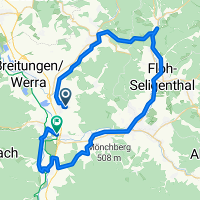
Ausfahrt durch Brotterode-Trusetal
A cycling route starting in Fambach, Thuringia, Germany.
Overview
About this route
- 1 h 5 min
- Duration
- 18.1 km
- Distance
- 589 m
- Ascent
- 125 m
- Descent
- 16.8 km/h
- Avg. speed
- ---
- Max. altitude

Continue with Bikemap
Use, edit, or download this cycling route
You would like to ride Ausfahrt durch Brotterode-Trusetal or customize it for your own trip? Here is what you can do with this Bikemap route:
Free features
- Save this route as favorite or in collections
- Copy & plan your own version of this route
- Sync your route with Garmin or Wahoo
Premium features
Free trial for 3 days, or one-time payment. More about Bikemap Premium.
- Navigate this route on iOS & Android
- Export a GPX / KML file of this route
- Create your custom printout (try it for free)
- Download this route for offline navigation
Discover more Premium features.
Get Bikemap PremiumFrom our community
Other popular routes starting in Fambach
 Kopf frei Runde
- Distance
- 21 km
- Ascent
- 307 m
- Descent
- 307 m
- Location
- Fambach, Thuringia, Germany
 Kleinschmalkalden - wallenburg - Henneberger Haus - Maienluft - Breitungen
- Distance
- 61.6 km
- Ascent
- 685 m
- Descent
- 686 m
- Location
- Fambach, Thuringia, Germany
 Ausfahrt durch Brotterode-Trusetal
- Distance
- 18.1 km
- Ascent
- 589 m
- Descent
- 125 m
- Location
- Fambach, Thuringia, Germany
 Marksuhl
- Distance
- 4.1 km
- Ascent
- 335 m
- Descent
- 392 m
- Location
- Fambach, Thuringia, Germany
 Fm-Mommelstein-Inselsberg-Dreiherrenstein-Hohe Klinge-Eisdiele Stumpf-FM
- Distance
- 49.2 km
- Ascent
- 836 m
- Descent
- 836 m
- Location
- Fambach, Thuringia, Germany
 Morning Fail
- Distance
- 17.5 km
- Ascent
- 326 m
- Descent
- 343 m
- Location
- Fambach, Thuringia, Germany
 Fambach- Mommelstein- Inselsberg- Ebertswiese- Schmalkalden- Fambach
- Distance
- 52.6 km
- Ascent
- 741 m
- Descent
- 741 m
- Location
- Fambach, Thuringia, Germany
 Wallenburgerturm - Arbeit
- Distance
- 38.6 km
- Ascent
- 482 m
- Descent
- 499 m
- Location
- Fambach, Thuringia, Germany
Open it in the app