

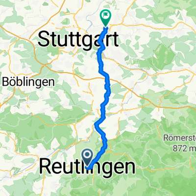
Reutlingen - Lindenhof - Stahleck - Lichtenstein - Kalkofen - Stuhlsteige - Reutlingen
A cycling route starting in Reutlingen, Baden-Wurttemberg, Germany.
Overview
About this route
Largely little-trafficked roads and farm tracks, a short section at Langenloch on an unpaved forest path that is still doable with a road bike. Stuhlsteige is relatively busy, but not too bothersome on the descent.
- -:--
- Duration
- 40.9 km
- Distance
- 708 m
- Ascent
- 708 m
- Descent
- ---
- Avg. speed
- ---
- Max. altitude

Continue with Bikemap
Use, edit, or download this cycling route
You would like to ride Reutlingen - Lindenhof - Stahleck - Lichtenstein - Kalkofen - Stuhlsteige - Reutlingen or customize it for your own trip? Here is what you can do with this Bikemap route:
Free features
- Save this route as favorite or in collections
- Copy & plan your own version of this route
- Sync your route with Garmin or Wahoo
Premium features
Free trial for 3 days, or one-time payment. More about Bikemap Premium.
- Navigate this route on iOS & Android
- Export a GPX / KML file of this route
- Create your custom printout (try it for free)
- Download this route for offline navigation
Discover more Premium features.
Get Bikemap PremiumFrom our community
Other popular routes starting in Reutlingen
 Reutlingen - Neckartal, Aichtal, Schönbuch, Tübingen - Reutlingen
- Distance
- 59 km
- Ascent
- 562 m
- Descent
- 597 m
- Location
- Reutlingen, Baden-Wurttemberg, Germany
 Lautertal
- Distance
- 75.8 km
- Ascent
- 952 m
- Descent
- 945 m
- Location
- Reutlingen, Baden-Wurttemberg, Germany
 Holzgerlingen - Ebersbach an der Fils
- Distance
- 48.4 km
- Ascent
- 594 m
- Descent
- 684 m
- Location
- Reutlingen, Baden-Wurttemberg, Germany
 Reutlingen Nürtingen Wendlingen 32km 110hm
- Distance
- 32.4 km
- Ascent
- 90 m
- Descent
- 217 m
- Location
- Reutlingen, Baden-Wurttemberg, Germany
 Reutlingen - St. Johann - Kohlstetten - Holzelfingen - Pfullingen - Reutlingen
- Distance
- 46.9 km
- Ascent
- 643 m
- Descent
- 581 m
- Location
- Reutlingen, Baden-Wurttemberg, Germany
 Rund um Achalm
- Distance
- 24.3 km
- Ascent
- 281 m
- Descent
- 281 m
- Location
- Reutlingen, Baden-Wurttemberg, Germany
 RT-St.Johann-Münsingen-Hohenstein-Undingen-Gönningen-RT
- Distance
- 84.1 km
- Ascent
- 830 m
- Descent
- 832 m
- Location
- Reutlingen, Baden-Wurttemberg, Germany
 Reutlingen - Lindenhof - Stahleck - Lichtenstein - Kalkofen - Stuhlsteige - Reutlingen
- Distance
- 40.9 km
- Ascent
- 708 m
- Descent
- 708 m
- Location
- Reutlingen, Baden-Wurttemberg, Germany
Open it in the app