
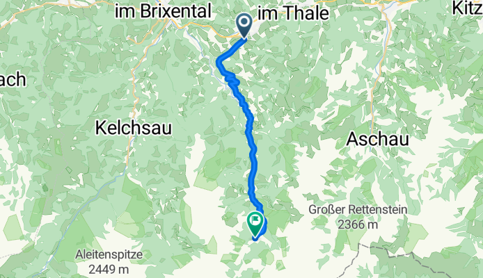
Windautaler Sprint 2017
A cycling route starting in Westendorf, Tyrol, Austria.
Overview
About this route
Windautaler Sprint 2017
- -:--
- Duration
- 14.3 km
- Distance
- 453 m
- Ascent
- 150 m
- Descent
- ---
- Avg. speed
- ---
- Max. altitude

Route quality
Waytypes & surfaces along the route
Waytypes
Road
7.7 km
(54 %)
Quiet road
3.3 km
(23 %)
Surfaces
Paved
11.2 km
(78 %)
Unpaved
3.1 km
(22 %)
Asphalt
11.2 km
(78 %)
Gravel
3.1 km
(22 %)
Route highlights
Points of interest along the route
Accommodation after 10.1 km
Gasthaus Steinberg
Continue with Bikemap
Use, edit, or download this cycling route
You would like to ride Windautaler Sprint 2017 or customize it for your own trip? Here is what you can do with this Bikemap route:
Free features
- Save this route as favorite or in collections
- Copy & plan your own version of this route
- Sync your route with Garmin or Wahoo
Premium features
Free trial for 3 days, or one-time payment. More about Bikemap Premium.
- Navigate this route on iOS & Android
- Export a GPX / KML file of this route
- Create your custom printout (try it for free)
- Download this route for offline navigation
Discover more Premium features.
Get Bikemap PremiumFrom our community
Other popular routes starting in Westendorf
 Holzham 120, Westendorf - Holzham 120, Westendorf
- Distance
- 37.9 km
- Ascent
- 1,180 m
- Descent
- 1,181 m
- Location
- Westendorf, Tyrol, Austria
 Holzham 120, Westendorf - Holzham 120, Westendorf
- Distance
- 19.3 km
- Ascent
- 918 m
- Descent
- 915 m
- Location
- Westendorf, Tyrol, Austria
 Brechhorn Kirchberg
- Distance
- 38.3 km
- Ascent
- 1,274 m
- Descent
- 2,128 m
- Location
- Westendorf, Tyrol, Austria
 Kälbersalvenalm - Singletrail
- Distance
- 19.8 km
- Ascent
- 886 m
- Descent
- 883 m
- Location
- Westendorf, Tyrol, Austria
 Windautaler Sprint 2017
- Distance
- 14.3 km
- Ascent
- 453 m
- Descent
- 150 m
- Location
- Westendorf, Tyrol, Austria
 Holzham 120, Westendorf - Holzham 120, Westendorf
- Distance
- 22.2 km
- Ascent
- 621 m
- Descent
- 623 m
- Location
- Westendorf, Tyrol, Austria
 Salvenrunde
- Distance
- 62.4 km
- Ascent
- 652 m
- Descent
- 653 m
- Location
- Westendorf, Tyrol, Austria
 Nagore ot Hotelo po mlekarskia pat
- Distance
- 5.5 km
- Ascent
- 539 m
- Descent
- 58 m
- Location
- Westendorf, Tyrol, Austria
Open it in the app