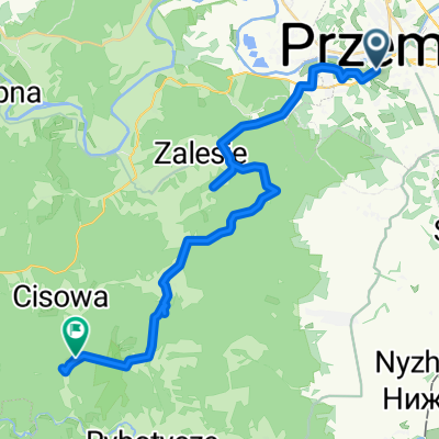
Phemsl-Krakow
A cycling route starting in Przemyśl, Subcarpathian Voivodeship, Poland.
Overview
About this route
- -:--
- Duration
- 95.7 km
- Distance
- 552 m
- Ascent
- 542 m
- Descent
- ---
- Avg. speed
- ---
- Avg. speed
Route quality
Waytypes & surfaces along the route
Waytypes
Busy road
29 km
(30 %)
Quiet road
24.3 km
(25 %)
Surfaces
Paved
60.8 km
(64 %)
Unpaved
5.2 km
(5 %)
Asphalt
56.2 km
(59 %)
Paved (undefined)
3.5 km
(4 %)
Route highlights
Points of interest along the route
Point of interest after 0.4 km
Костел св. Антонія Падевського та монастир францисканців-реформаторів
Point of interest after 1 km
Рыночная площадь
Point of interest after 1.3 km
Костел святой марии
Point of interest after 1.3 km
СОБОР
Point of interest after 1.7 km
Казимирський замок
Point of interest after 1.9 km
Базиліка Вознесіння Богородиці та св. Іоана Хрестителя
Point of interest after 2.1 km
Татарський пагорб Татарським у Перемишлі називають пагорб, який розташований на південній окраїні міста у районі, який носить назву Знесіння. Висота Татарського пагорба становить 352 м над рівнем моря. Згідно легенди, його у IX ст. насипали татари для того, щоб поховати на ньому свого хана, який загинув у бою. Впродовж століть Татарський пагорб відігравав роль важливого пункту спостереження в оборонній системі Перемишльщини. Сьогодні пагорб ще називають вершиною Пшемислава, легендарного засновника міста Перемишль. Адреса: м. Перемишль, ul. Przemysława GPS: N 49.770345 E 22.772552
Point of interest after 2.3 km
Костел св. Терези та монастир кармелітів босих
Point of interest after 2.6 km
Годинникова башта
Point of interest after 52 km
53 км ночь №1 Озеро Перед съездом на заправке можно набрать воды
Point of interest after 69.8 km
Красивый парк и замок. ПОСМОТРЕТЬ.
Point of interest after 93.9 km
Солевая копальня
Point of interest after 93.9 km
ЗАМОК
Point of interest after 93.9 km
КОпальня соли
Point of interest after 94.7 km
Рыночная площадь
Continue with Bikemap
Use, edit, or download this cycling route
You would like to ride Phemsl-Krakow or customize it for your own trip? Here is what you can do with this Bikemap route:
Free features
- Save this route as favorite or in collections
- Copy & plan your own version of this route
- Split it into stages to create a multi-day tour
- Sync your route with Garmin or Wahoo
Premium features
Free trial for 3 days, or one-time payment. More about Bikemap Premium.
- Navigate this route on iOS & Android
- Export a GPX / KML file of this route
- Create your custom printout (try it for free)
- Download this route for offline navigation
Discover more Premium features.
Get Bikemap PremiumFrom our community
Other popular routes starting in Przemyśl
- Przemyśl (Gmina) Bieg
- Distance
- 27.8 km
- Ascent
- 581 m
- Descent
- 582 m
- Location
- Przemyśl, Subcarpathian Voivodeship, Poland
- Cyklokarpaty 2013 - Twierdza Przemyśl - HOBBY
- Distance
- 11.6 km
- Ascent
- 322 m
- Descent
- 322 m
- Location
- Przemyśl, Subcarpathian Voivodeship, Poland
- Przemyśl-Kalników-Korczowa-Radymno-Przemyśl
- Distance
- 81.1 km
- Ascent
- 197 m
- Descent
- 197 m
- Location
- Przemyśl, Subcarpathian Voivodeship, Poland
- Ignacego Prądzyńskiego 21, Przemyśl do Gen. Prądzyńskiego 23, Przemyśl
- Distance
- 21.3 km
- Ascent
- 657 m
- Descent
- 653 m
- Location
- Przemyśl, Subcarpathian Voivodeship, Poland
- Przemyśl-Prałkowce-Brylińce-Krasiczyn-Przemyśl
- Distance
- 41.2 km
- Ascent
- 487 m
- Descent
- 495 m
- Location
- Przemyśl, Subcarpathian Voivodeship, Poland
- BIES - KIDY 2016.07
- Distance
- 570.4 km
- Ascent
- 1,675 m
- Descent
- 1,721 m
- Location
- Przemyśl, Subcarpathian Voivodeship, Poland
- Gen. Prądzyńskiego 26, Przemyśl do Marcina Bielskiego 66, Przemyśl
- Distance
- 34.7 km
- Ascent
- 1,608 m
- Descent
- 1,632 m
- Location
- Przemyśl, Subcarpathian Voivodeship, Poland
- Przemysl - wisan
- Distance
- 95.2 km
- Ascent
- 1,970 m
- Descent
- 1,692 m
- Location
- Przemyśl, Subcarpathian Voivodeship, Poland
Open it in the app