

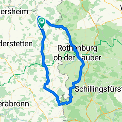
Creglingen-Neunkirchen 2, 119km, Crossrad
A cycling route starting in Creglingen, Baden-Wurttemberg, Germany.
Overview
About this route
Alternating between roads, bike paths, and hiking trails with the Cyco Cross through the Staigerwald from Taubertal to Neunkirchen am Brand, home of cycling culture
- -:--
- Duration
- 118.9 km
- Distance
- 730 m
- Ascent
- 663 m
- Descent
- ---
- Avg. speed
- ---
- Max. altitude
Route quality
Waytypes & surfaces along the route
Waytypes
Road
53.5 km
(45 %)
Quiet road
22.6 km
(19 %)
Surfaces
Paved
77.3 km
(65 %)
Unpaved
7.1 km
(6 %)
Asphalt
77.3 km
(65 %)
Gravel
4.8 km
(4 %)
Continue with Bikemap
Use, edit, or download this cycling route
You would like to ride Creglingen-Neunkirchen 2, 119km, Crossrad or customize it for your own trip? Here is what you can do with this Bikemap route:
Free features
- Save this route as favorite or in collections
- Copy & plan your own version of this route
- Split it into stages to create a multi-day tour
- Sync your route with Garmin or Wahoo
Premium features
Free trial for 3 days, or one-time payment. More about Bikemap Premium.
- Navigate this route on iOS & Android
- Export a GPX / KML file of this route
- Create your custom printout (try it for free)
- Download this route for offline navigation
Discover more Premium features.
Get Bikemap PremiumFrom our community
Other popular routes starting in Creglingen
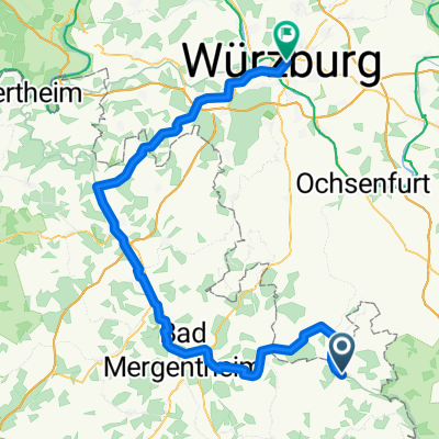
 Tauber-Main_01
- Distance
- 70.8 km
- Ascent
- 675 m
- Descent
- 669 m
- Location
- Creglingen, Baden-Wurttemberg, Germany
 Tour 2020 Etappe 6
- Distance
- 89.9 km
- Ascent
- 309 m
- Descent
- 400 m
- Location
- Creglingen, Baden-Wurttemberg, Germany
 Archshofen (Taubertal) --> Heidelberg (Neckartal)
- Distance
- 173.5 km
- Ascent
- 393 m
- Descent
- 569 m
- Location
- Creglingen, Baden-Wurttemberg, Germany
 Taubertal <--> Maintal (Archshofen - Würzburg)
- Distance
- 52.6 km
- Ascent
- 380 m
- Descent
- 508 m
- Location
- Creglingen, Baden-Wurttemberg, Germany
 Creglingen-Freudenbach-Runde
- Distance
- 18.6 km
- Ascent
- 171 m
- Descent
- 162 m
- Location
- Creglingen, Baden-Wurttemberg, Germany
 awv60a-Creiglingen-Weikersheim Bhf
- Distance
- 18.4 km
- Ascent
- 135 m
- Descent
- 171 m
- Location
- Creglingen, Baden-Wurttemberg, Germany
 Archshofen - Crailsheim
- Distance
- 42.4 km
- Ascent
- 330 m
- Descent
- 225 m
- Location
- Creglingen, Baden-Wurttemberg, Germany
 TT51, D9 Creglingen - Weikersheim
- Distance
- 19.6 km
- Ascent
- 93 m
- Descent
- 148 m
- Location
- Creglingen, Baden-Wurttemberg, Germany
Open it in the app