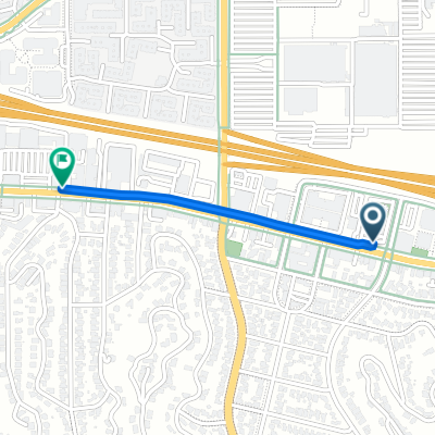
Trillium to De Soto Orange Line station
- 1.5 km
- 0 m
- 9 m
- Woodland Hills, California, United States
Pedestrian area
1 km70 %Cycleway
0.4 km26 %Paved
1.3 km(89 %)Concrete
0.9 km63 %Asphalt
0.4 km26 %Undefined
0.2 km11 %Free trial for 3 days, or one-time payment. More about Bikemap Premium.
Discover more Premium features.
Get Bikemap PremiumOpen it in the app