

Trasa teka na 5 in 9 km z označenimi reditelji
A cycling route starting in Podvelka, Podvelka, Slovenia.
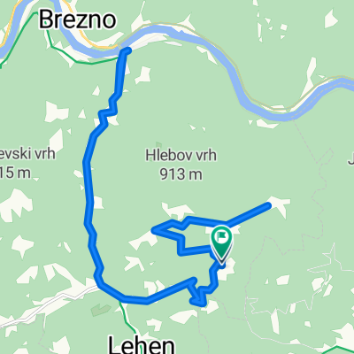
Overview
About this route
Marshals will be positioned at all public road junctions along the designated route. In the event area at the finish, there will be 3 marshals and a fire engine. These marshals will also monitor the fenced area towards the Drava River.
- -:--
- Duration
- 1.5 km
- Distance
- 33 m
- Ascent
- 47 m
- Descent
- ---
- Avg. speed
- ---
- Max. altitude
Route quality
Waytypes & surfaces along the route
Waytypes
Cycleway
1 km
(69 %)
Quiet road
0.3 km
(19 %)
Access road
0.2 km
(12 %)
Surfaces
Paved
0.3 km
(22 %)
Asphalt
0.3 km
(22 %)
Undefined
1.2 km
(78 %)
Route highlights
Points of interest along the route
Point of interest after 0 km
Reditelj 1
Point of interest after 0.1 km
Reditelj 2
Point of interest after 0.1 km
Reditelj 3
Point of interest after 0.3 km
Reditelj 4
Point of interest after 0.8 km
Reditelj 5
Point of interest after 1.3 km
Reditelj 6
Point of interest after 1.3 km
Reditelj 7
Point of interest after 1.5 km
Reditelj 9
Point of interest after 1.5 km
gasilska cisterna
Point of interest after 1.5 km
Reditelj 8
Point of interest after 1.5 km
Reditelj 10
Continue with Bikemap
Use, edit, or download this cycling route
You would like to ride Trasa teka na 5 in 9 km z označenimi reditelji or customize it for your own trip? Here is what you can do with this Bikemap route:
Free features
- Save this route as favorite or in collections
- Copy & plan your own version of this route
- Sync your route with Garmin or Wahoo
Premium features
Free trial for 3 days, or one-time payment. More about Bikemap Premium.
- Navigate this route on iOS & Android
- Export a GPX / KML file of this route
- Create your custom printout (try it for free)
- Download this route for offline navigation
Discover more Premium features.
Get Bikemap PremiumFrom our community
Other popular routes starting in Podvelka
 Ožbalt Dolenjske toplice Kraljevica Novalja
- Distance
- 538.1 km
- Ascent
- 1,981 m
- Descent
- 2,293 m
- Location
- Podvelka, Podvelka, Slovenia
 flosarska pot
- Distance
- 37.5 km
- Ascent
- 1,056 m
- Descent
- 1,055 m
- Location
- Podvelka, Podvelka, Slovenia
 Braber - Podvelka - Glancnik - Braber
- Distance
- 23 km
- Ascent
- 597 m
- Descent
- 586 m
- Location
- Podvelka, Podvelka, Slovenia
 Braber to Glancnik and back
- Distance
- 7.6 km
- Ascent
- 304 m
- Descent
- 303 m
- Location
- Podvelka, Podvelka, Slovenia
 po Rdečem Bregu
- Distance
- 24 km
- Ascent
- 705 m
- Descent
- 705 m
- Location
- Podvelka, Podvelka, Slovenia
 Trasa teka na 5 in 9 km z označenimi reditelji
- Distance
- 1.5 km
- Ascent
- 33 m
- Descent
- 47 m
- Location
- Podvelka, Podvelka, Slovenia
 po Breznem Vrhu
- Distance
- 22.8 km
- Ascent
- 543 m
- Descent
- 542 m
- Location
- Podvelka, Podvelka, Slovenia
 Iz Ožbalta na Pag
- Distance
- 537 km
- Ascent
- 1,907 m
- Descent
- 2,219 m
- Location
- Podvelka, Podvelka, Slovenia
Open it in the app