
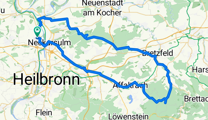
Neckarsulm-Dahenfeld-Brettach-Scheppach-Obersulm-Erlenbach-Neckarsulm
A cycling route starting in Untereisesheim, Baden-Württemberg, Germany.
Overview
About this route
Schöner Trail von Dahenfeld bis Brettach, weiter durchs Brettachtal, übern Berg nach Obersulm und im Sulmtal zurück, Schotter/Waldweg und Asphalt
- -:--
- Duration
- 61.6 km
- Distance
- 401 m
- Ascent
- 400 m
- Descent
- ---
- Avg. speed
- ---
- Max. altitude
Route quality
Waytypes & surfaces along the route
Waytypes
Track
30.8 km
(50 %)
Quiet road
12.1 km
(20 %)
Surfaces
Paved
41.9 km
(68 %)
Unpaved
18.7 km
(30 %)
Asphalt
38.9 km
(63 %)
Gravel
7.4 km
(12 %)
Continue with Bikemap
Use, edit, or download this cycling route
You would like to ride Neckarsulm-Dahenfeld-Brettach-Scheppach-Obersulm-Erlenbach-Neckarsulm or customize it for your own trip? Here is what you can do with this Bikemap route:
Free features
- Save this route as favorite or in collections
- Copy & plan your own version of this route
- Sync your route with Garmin or Wahoo
Premium features
Free trial for 3 days, or one-time payment. More about Bikemap Premium.
- Navigate this route on iOS & Android
- Export a GPX / KML file of this route
- Create your custom printout (try it for free)
- Download this route for offline navigation
Discover more Premium features.
Get Bikemap PremiumFrom our community
Other popular routes starting in Untereisesheim
 BFH Schillerstr. - UEH - Allmend Höfe - Bonfeld - Treschklingen - Kirchhardt - Berwangen - Weinsberger Jagdhaus - Gebauers Ruh - Schwaigern - Leintal - Neckar -
- Distance
- 54.6 km
- Ascent
- 295 m
- Descent
- 295 m
- Location
- Untereisesheim, Baden-Württemberg, Germany
 FDR BFH Schillerstr - N'gartach - Hipfelhof - Annalinde - Kirchhausen - Stöckach (Wald) - Treschklingen - Bad Rappenau - Waldschenke OEH - BFH Schillerstr.
- Distance
- 49.2 km
- Ascent
- 412 m
- Descent
- 412 m
- Location
- Untereisesheim, Baden-Württemberg, Germany
 BFH - Sulm/Rot/Kocher - AA/HDH - Brenz/Mindel - Bad Wörishfn - Kaufbeurn - Füssen - Imst - Reschen - Meran - Cles - Molveno - Toblino/Riva/Gardasee - Rovereto
- Distance
- 698.9 km
- Ascent
- 9,623 m
- Descent
- 9,604 m
- Location
- Untereisesheim, Baden-Württemberg, Germany
 Bad Friedrichshall-Jagshausen-Runde
- Distance
- 78.7 km
- Ascent
- 545 m
- Descent
- 544 m
- Location
- Untereisesheim, Baden-Württemberg, Germany
 Tour de Burg Hornberg Extended
- Distance
- 67.8 km
- Ascent
- 637 m
- Descent
- 637 m
- Location
- Untereisesheim, Baden-Württemberg, Germany
 Bad Friedrichshall - Jagst
- Distance
- 18.8 km
- Ascent
- 140 m
- Descent
- 143 m
- Location
- Untereisesheim, Baden-Württemberg, Germany
 NE - Kochendorf - Singletrail NE Dahenfeld - Scheppach - Obersulm - Erlenbach - NE
- Distance
- 51.7 km
- Ascent
- 288 m
- Descent
- 288 m
- Location
- Untereisesheim, Baden-Württemberg, Germany
 Tour de Löwenstein + Pershing Besichtigung
- Distance
- 90.1 km
- Ascent
- 620 m
- Descent
- 619 m
- Location
- Untereisesheim, Baden-Württemberg, Germany
Open it in the app