

Oder-Neisse Radweg (Cedynia-Nowe Warpno)
A cycling route starting in Cedynia, West Pomeranian Voivodeship, Poland.
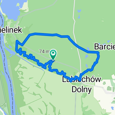
Overview
About this route
- -:--
- Duration
- 142.2 km
- Distance
- 179 m
- Ascent
- 180 m
- Descent
- ---
- Avg. speed
- ---
- Max. altitude

Route quality
Waytypes & surfaces along the route
Waytypes
Quiet road
38.4 km
(27 %)
Track
38.4 km
(27 %)
Surfaces
Paved
106.6 km
(75 %)
Unpaved
4.3 km
(3 %)
Asphalt
102.4 km
(72 %)
Concrete
2.8 km
(2 %)
Continue with Bikemap
Use, edit, or download this cycling route
You would like to ride Oder-Neisse Radweg (Cedynia-Nowe Warpno) or customize it for your own trip? Here is what you can do with this Bikemap route:
Free features
- Save this route as favorite or in collections
- Copy & plan your own version of this route
- Split it into stages to create a multi-day tour
- Sync your route with Garmin or Wahoo
Premium features
Free trial for 3 days, or one-time payment. More about Bikemap Premium.
- Navigate this route on iOS & Android
- Export a GPX / KML file of this route
- Create your custom printout (try it for free)
- Download this route for offline navigation
Discover more Premium features.
Get Bikemap PremiumFrom our community
Other popular routes starting in Cedynia
 Trasa Pojezierzy Zachodnich
- Distance
- 339.9 km
- Ascent
- 1,351 m
- Descent
- 1,222 m
- Location
- Cedynia, West Pomeranian Voivodeship, Poland
 Dookoła Polski 14 dzień ( Orzechów-Wolin)
- Distance
- 169.5 km
- Ascent
- 241 m
- Descent
- 310 m
- Location
- Cedynia, West Pomeranian Voivodeship, Poland
 Zachód PIASEK - SZCZECIN
- Distance
- 67.7 km
- Ascent
- 276 m
- Descent
- 262 m
- Location
- Cedynia, West Pomeranian Voivodeship, Poland
 Cedynia - Kostrzyn
- Distance
- 61.1 km
- Ascent
- 156 m
- Descent
- 142 m
- Location
- Cedynia, West Pomeranian Voivodeship, Poland
 26 Cedynia-Sulecin
- Distance
- 102.8 km
- Ascent
- 212 m
- Descent
- 136 m
- Location
- Cedynia, West Pomeranian Voivodeship, Poland
 Bielinek i Świergotka
- Distance
- 14.1 km
- Ascent
- 203 m
- Descent
- 202 m
- Location
- Cedynia, West Pomeranian Voivodeship, Poland
 Siekierki - Gdynia
- Distance
- 596.1 km
- Ascent
- 2,844 m
- Descent
- 2,773 m
- Location
- Cedynia, West Pomeranian Voivodeship, Poland
 Grenzgänge 19_20130705_1
- Distance
- 98.8 km
- Ascent
- 252 m
- Descent
- 253 m
- Location
- Cedynia, West Pomeranian Voivodeship, Poland
Open it in the app