

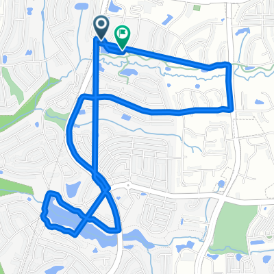
45-mile route from Western Cary through Jordan Lake dam
A cycling route starting in Green Level, North Carolina, United States.
Overview
About this route
From the top of dam you can descent down on gravel road and pick up abandoned road to jump on Pea Ridge Rd so you don't have to retract back
- -:--
- Duration
- 85.6 km
- Distance
- 226 m
- Ascent
- 222 m
- Descent
- ---
- Avg. speed
- ---
- Max. altitude

Route quality
Waytypes & surfaces along the route
Waytypes
Road
29.1 km
(34 %)
Quiet road
21.4 km
(25 %)
Surfaces
Paved
52.2 km
(61 %)
Unpaved
1.7 km
(2 %)
Asphalt
51.4 km
(60 %)
Gravel
1.7 km
(2 %)
Continue with Bikemap
Use, edit, or download this cycling route
You would like to ride 45-mile route from Western Cary through Jordan Lake dam or customize it for your own trip? Here is what you can do with this Bikemap route:
Free features
- Save this route as favorite or in collections
- Copy & plan your own version of this route
- Split it into stages to create a multi-day tour
- Sync your route with Garmin or Wahoo
Premium features
Free trial for 3 days, or one-time payment. More about Bikemap Premium.
- Navigate this route on iOS & Android
- Export a GPX / KML file of this route
- Create your custom printout (try it for free)
- Download this route for offline navigation
Discover more Premium features.
Get Bikemap PremiumFrom our community
Other popular routes starting in Green Level
 635 Finnbar Dr, Cary to 580–598 Finnbar Dr, Cary
- Distance
- 6.5 km
- Ascent
- 195 m
- Descent
- 190 m
- Location
- Green Level, North Carolina, United States
 56 New Hope
- Distance
- 90.6 km
- Ascent
- 314 m
- Descent
- 313 m
- Location
- Green Level, North Carolina, United States
 57-mile route around Jordan Lake, then dam and Tobacco trail
- Distance
- 99.1 km
- Ascent
- 383 m
- Descent
- 384 m
- Location
- Green Level, North Carolina, United States
 Home - New Hope - Chatham
- Distance
- 35.1 km
- Ascent
- 153 m
- Descent
- 152 m
- Location
- Green Level, North Carolina, United States
 West Cary / Chatham
- Distance
- 71.5 km
- Ascent
- 200 m
- Descent
- 200 m
- Location
- Green Level, North Carolina, United States
 70-mile route from Western Cary though Tiger Rescue and Jordan Lake dam
- Distance
- 116.2 km
- Ascent
- 370 m
- Descent
- 372 m
- Location
- Green Level, North Carolina, United States
 f1xedgear's commute route
- Distance
- 33.8 km
- Ascent
- 129 m
- Descent
- 145 m
- Location
- Green Level, North Carolina, United States
 Roll'n on 20's.
- Distance
- 31.5 km
- Ascent
- 187 m
- Descent
- 186 m
- Location
- Green Level, North Carolina, United States
Open it in the app