

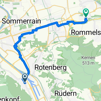
siebenmühlental
A cycling route starting in Stuttgart-Ost, Baden-Wurttemberg, Germany.
Overview
About this route
- -:--
- Duration
- 49.2 km
- Distance
- 513 m
- Ascent
- 508 m
- Descent
- ---
- Avg. speed
- ---
- Max. altitude

Route quality
Waytypes & surfaces along the route
Waytypes
Track
15.3 km
(31 %)
Quiet road
10.8 km
(22 %)
Surfaces
Paved
44.3 km
(90 %)
Unpaved
5.4 km
(11 %)
Asphalt
42.3 km
(86 %)
Gravel
2.5 km
(5 %)
Continue with Bikemap
Use, edit, or download this cycling route
You would like to ride siebenmühlental or customize it for your own trip? Here is what you can do with this Bikemap route:
Free features
- Save this route as favorite or in collections
- Copy & plan your own version of this route
- Sync your route with Garmin or Wahoo
Premium features
Free trial for 3 days, or one-time payment. More about Bikemap Premium.
- Navigate this route on iOS & Android
- Export a GPX / KML file of this route
- Create your custom printout (try it for free)
- Download this route for offline navigation
Discover more Premium features.
Get Bikemap PremiumFrom our community
Other popular routes starting in Stuttgart-Ost
 siebenmühlental
- Distance
- 49.2 km
- Ascent
- 513 m
- Descent
- 508 m
- Location
- Stuttgart-Ost, Baden-Wurttemberg, Germany
 SonntagsfahrerJubitour 2008
- Distance
- 15 km
- Ascent
- 380 m
- Descent
- 378 m
- Location
- Stuttgart-Ost, Baden-Wurttemberg, Germany
 Tour 30. Juli 2025 - Variante neu
- Distance
- 214.6 km
- Ascent
- 3,122 m
- Descent
- 3,122 m
- Location
- Stuttgart-Ost, Baden-Wurttemberg, Germany
 Feierabendrunde
- Distance
- 39.1 km
- Ascent
- 494 m
- Descent
- 466 m
- Location
- Stuttgart-Ost, Baden-Wurttemberg, Germany
 Rössleweg
- Distance
- 56.2 km
- Ascent
- 778 m
- Descent
- 778 m
- Location
- Stuttgart-Ost, Baden-Wurttemberg, Germany
 Wasenstraße, Stuttgart nach Donauschwabenstraße, Waiblingen
- Distance
- 11.8 km
- Ascent
- 119 m
- Descent
- 82 m
- Location
- Stuttgart-Ost, Baden-Wurttemberg, Germany
 Deckerstraße nach Bahnhofstraße 40/1
- Distance
- 50.3 km
- Ascent
- 925 m
- Descent
- 928 m
- Location
- Stuttgart-Ost, Baden-Wurttemberg, Germany
 rotenberg - lederberg - zollberg
- Distance
- 40.6 km
- Ascent
- 647 m
- Descent
- 625 m
- Location
- Stuttgart-Ost, Baden-Wurttemberg, Germany
Open it in the app