

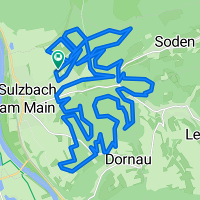
Sulzbach - Glattbach
A cycling route starting in Sulzbach am Main, Bavaria, Germany.
Overview
About this route
From the sports hall in Sulzbach along the Main cycling path, via Perth Inch, Strietwald, the dog park to Glattbach...
- -:--
- Duration
- 23.4 km
- Distance
- 140 m
- Ascent
- 74 m
- Descent
- ---
- Avg. speed
- 205 m
- Max. altitude

Route quality
Waytypes & surfaces along the route
Waytypes
Quiet road
7.7 km
(33 %)
Track
4.9 km
(21 %)
Surfaces
Paved
19.9 km
(85 %)
Unpaved
1.4 km
(6 %)
Asphalt
19.2 km
(82 %)
Unpaved (undefined)
0.7 km
(3 %)
Continue with Bikemap
Use, edit, or download this cycling route
You would like to ride Sulzbach - Glattbach or customize it for your own trip? Here is what you can do with this Bikemap route:
Free features
- Save this route as favorite or in collections
- Copy & plan your own version of this route
- Sync your route with Garmin or Wahoo
Premium features
Free trial for 3 days, or one-time payment. More about Bikemap Premium.
- Navigate this route on iOS & Android
- Export a GPX / KML file of this route
- Create your custom printout (try it for free)
- Download this route for offline navigation
Discover more Premium features.
Get Bikemap PremiumFrom our community
Other popular routes starting in Sulzbach am Main
 CTF-Sulzbach-2009-Hessen
- Distance
- 31.6 km
- Ascent
- 896 m
- Descent
- 849 m
- Location
- Sulzbach am Main, Bavaria, Germany
 1. ausgeschilderte MTB Strecke Sulzbach
- Distance
- 28.7 km
- Ascent
- 542 m
- Descent
- 542 m
- Location
- Sulzbach am Main, Bavaria, Germany
 1. ausgeschilderte MTB Strecke Sulzbach
- Distance
- 28.7 km
- Ascent
- 573 m
- Descent
- 576 m
- Location
- Sulzbach am Main, Bavaria, Germany
 Volkersbrunn-Mespelbrunn-Weibersbrunn-Eschau-Obernburg
- Distance
- 68.7 km
- Ascent
- 629 m
- Descent
- 629 m
- Location
- Sulzbach am Main, Bavaria, Germany
 Sulzbach-Eichelsbach-Geishöhe-Volkersbrunn
- Distance
- 49.7 km
- Ascent
- 957 m
- Descent
- 858 m
- Location
- Sulzbach am Main, Bavaria, Germany
 Honischer Weizenrunde
- Distance
- 26.8 km
- Ascent
- 525 m
- Descent
- 525 m
- Location
- Sulzbach am Main, Bavaria, Germany
 CTF Sulzbach im Spessart
- Distance
- 32.7 km
- Ascent
- 623 m
- Descent
- 623 m
- Location
- Sulzbach am Main, Bavaria, Germany
 Sulzbach Kirche - Geishöhe
- Distance
- 17.4 km
- Ascent
- 654 m
- Descent
- 254 m
- Location
- Sulzbach am Main, Bavaria, Germany
Open it in the app