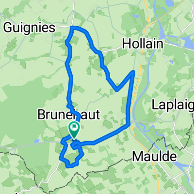
20170902 Super Cee V18/06/2017 13:27
A cycling route starting in Antoing, Wallonia, Belgium.
Overview
About this route
- -:--
- Duration
- 59.9 km
- Distance
- 94 m
- Ascent
- 92 m
- Descent
- ---
- Avg. speed
- ---
- Max. altitude
Route quality
Waytypes & surfaces along the route
Waytypes
Quiet road
31.8 km
(53 %)
Road
15 km
(25 %)
Surfaces
Paved
18 km
(30 %)
Unpaved
3 km
(5 %)
Asphalt
15.6 km
(26 %)
Gravel
2.4 km
(4 %)
Route highlights
Points of interest along the route
Drinking water after 31.5 km
Opgepast rechts afslaan
Point of interest after 35.8 km
La Croix ou Pile +33 3 20 71 71 87 Rue du Ghien, 59310 Beuvry-la-Forêt
Continue with Bikemap
Use, edit, or download this cycling route
You would like to ride 20170902 Super Cee V18/06/2017 13:27 or customize it for your own trip? Here is what you can do with this Bikemap route:
Free features
- Save this route as favorite or in collections
- Copy & plan your own version of this route
- Sync your route with Garmin or Wahoo
Premium features
Free trial for 3 days, or one-time payment. More about Bikemap Premium.
- Navigate this route on iOS & Android
- Export a GPX / KML file of this route
- Create your custom printout (try it for free)
- Download this route for offline navigation
Discover more Premium features.
Get Bikemap PremiumFrom our community
Other popular routes starting in Antoing
 Itinéraire vers Résidence du Bourgeon 23, Tournai
- Distance
- 3.8 km
- Ascent
- 0 m
- Descent
- 50 m
- Location
- Antoing, Wallonia, Belgium
 Doornik Saint Quentin
- Distance
- 104.7 km
- Ascent
- 277 m
- Descent
- 213 m
- Location
- Antoing, Wallonia, Belgium
 20170707_082220.gpx
- Distance
- 15.1 km
- Ascent
- 58 m
- Descent
- 41 m
- Location
- Antoing, Wallonia, Belgium
 Vélotaf 2805
- Distance
- 32.5 km
- Ascent
- 66 m
- Descent
- 83 m
- Location
- Antoing, Wallonia, Belgium
 20170902 Super Cee V18/06/2017 13:27
- Distance
- 59.9 km
- Ascent
- 94 m
- Descent
- 92 m
- Location
- Antoing, Wallonia, Belgium
 De Rue Rosée 14, Brunehaut à Rue Rosée 14, Brunehaut
- Distance
- 16.6 km
- Ascent
- 61 m
- Descent
- 58 m
- Location
- Antoing, Wallonia, Belgium
 Inlinemap "Bush Classic" Adapted Rollers 50 Km
- Distance
- 49.8 km
- Ascent
- 126 m
- Descent
- 123 m
- Location
- Antoing, Wallonia, Belgium
 Road #P03 - Callenelle
- Distance
- 14.5 km
- Ascent
- 71 m
- Descent
- 69 m
- Location
- Antoing, Wallonia, Belgium
Open it in the app


