

sortie entrainement
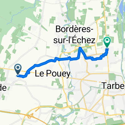
A cycling route starting in Ibos, Occitanie, France.
Overview
About this route
classique
- -:--
- Duration
- 57.5 km
- Distance
- 326 m
- Ascent
- 327 m
- Descent
- ---
- Avg. speed
- ---
- Max. altitude
Continue with Bikemap
Use, edit, or download this cycling route
You would like to ride sortie entrainement or customize it for your own trip? Here is what you can do with this Bikemap route:
Free features
- Save this route as favorite or in collections
- Copy & plan your own version of this route
- Sync your route with Garmin or Wahoo
Premium features
Free trial for 3 days, or one-time payment. More about Bikemap Premium.
- Navigate this route on iOS & Android
- Export a GPX / KML file of this route
- Create your custom printout (try it for free)
- Download this route for offline navigation
Discover more Premium features.
Get Bikemap PremiumFrom our community
Other popular routes starting in Ibos
 Chemin de la Passade, Ibos à 9 Avenue Jean Jaurès, Oursbelille
- Distance
- 10.4 km
- Ascent
- 13 m
- Descent
- 105 m
- Location
- Ibos, Occitanie, France
 23 Route de Pau, Ibos à 20 Rue de Miramont, Tarbes
- Distance
- 7.6 km
- Ascent
- 316 m
- Descent
- 0 m
- Location
- Ibos, Occitanie, France
 bcommandeur
- Distance
- 11.4 km
- Ascent
- 1,738 m
- Descent
- 1,747 m
- Location
- Ibos, Occitanie, France
 Etapa Tour 14 Tourmalet
- Distance
- 116.5 km
- Ascent
- 3,014 m
- Descent
- 1,334 m
- Location
- Ibos, Occitanie, France
 Commander
- Distance
- 4.7 km
- Ascent
- 98 m
- Descent
- 97 m
- Location
- Ibos, Occitanie, France
 Côte de Ger, Ibos to Cheminement Lescloupe, Aast
- Distance
- 10.6 km
- Ascent
- 116 m
- Descent
- 61 m
- Location
- Ibos, Occitanie, France
 Etapa 14 Tour
- Distance
- 116 km
- Ascent
- 3,096 m
- Descent
- 1,314 m
- Location
- Ibos, Occitanie, France
 De Chemin d'Ours à Avenue Alsace-Lorraine Ter
- Distance
- 7.5 km
- Ascent
- 7 m
- Descent
- 24 m
- Location
- Ibos, Occitanie, France
Open it in the app