

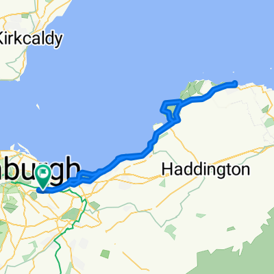
Alternative 2017 Original Edinburgh Nightride route
A cycling route starting in Seafield, Scotland, United Kingdom.
Overview
About this route
avoiding two potentially busy fast A road sections
- -:--
- Duration
- 101 km
- Distance
- 354 m
- Ascent
- 354 m
- Descent
- ---
- Avg. speed
- ---
- Max. altitude
Route quality
Waytypes & surfaces along the route
Waytypes
Busy road
35.2 km
(35 %)
Road
28.5 km
(28 %)
Surfaces
Paved
89.7 km
(89 %)
Unpaved
0.3 km
(<1 %)
Asphalt
88.8 km
(88 %)
Paved (undefined)
0.8 km
(<1 %)
Continue with Bikemap
Use, edit, or download this cycling route
You would like to ride Alternative 2017 Original Edinburgh Nightride route or customize it for your own trip? Here is what you can do with this Bikemap route:
Free features
- Save this route as favorite or in collections
- Copy & plan your own version of this route
- Split it into stages to create a multi-day tour
- Sync your route with Garmin or Wahoo
Premium features
Free trial for 3 days, or one-time payment. More about Bikemap Premium.
- Navigate this route on iOS & Android
- Export a GPX / KML file of this route
- Create your custom printout (try it for free)
- Download this route for offline navigation
Discover more Premium features.
Get Bikemap PremiumFrom our community
Other popular routes starting in Seafield
 12 Niddrie Marischal Street, Edinburgh to 10 Niddrie Marischal Street, Edinburgh
- Distance
- 72.5 km
- Ascent
- 29 m
- Descent
- 71 m
- Location
- Seafield, Scotland, United Kingdom
 North Edinburgh paths from Water of Leith
- Distance
- 12.3 km
- Ascent
- 44 m
- Descent
- 43 m
- Location
- Seafield, Scotland, United Kingdom
 Leith Cycle Co to the Prom for a snack
- Distance
- 5.6 km
- Ascent
- 0 m
- Descent
- 9 m
- Location
- Seafield, Scotland, United Kingdom
 Leith to Cockenzie Railway
- Distance
- 16.6 km
- Ascent
- 56 m
- Descent
- 49 m
- Location
- Seafield, Scotland, United Kingdom
 Porty HS to Musselburgh Lagoons
- Distance
- 21.6 km
- Ascent
- 60 m
- Descent
- 89 m
- Location
- Seafield, Scotland, United Kingdom
 Dalkeith/Vogrie/Crichton/Pathhead/Cousland Loop
- Distance
- 45.6 km
- Ascent
- 413 m
- Descent
- 406 m
- Location
- Seafield, Scotland, United Kingdom
 Leith - Water of Leith - paths network back to Leith
- Distance
- 14.1 km
- Ascent
- 85 m
- Descent
- 86 m
- Location
- Seafield, Scotland, United Kingdom
 Leith Academy to Cramond
- Distance
- 25.9 km
- Ascent
- 132 m
- Descent
- 134 m
- Location
- Seafield, Scotland, United Kingdom
Open it in the app