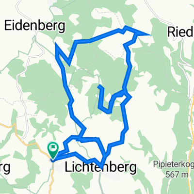
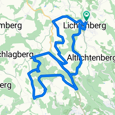
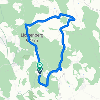
Eidenbergerhütte (Gis, Wolfgang Kapelle, Römerberghütte
A cycling route starting in Eidenberg, Upper Austria, Austria.
Overview
About this route
Ein bischen im Wald umadum.
Test & Gegendanschaun wo ma fahen kann!?
- -:--
- Duration
- 15 km
- Distance
- 444 m
- Ascent
- 444 m
- Descent
- ---
- Avg. speed
- ---
- Avg. speed
Route quality
Waytypes & surfaces along the route
Waytypes
Track
6.7 km
(45 %)
Quiet road
4.4 km
(29 %)
Surfaces
Paved
2.5 km
(17 %)
Unpaved
7.4 km
(49 %)
Ground
3.1 km
(21 %)
Unpaved (undefined)
2.4 km
(16 %)
Continue with Bikemap
Use, edit, or download this cycling route
You would like to ride Eidenbergerhütte (Gis, Wolfgang Kapelle, Römerberghütte or customize it for your own trip? Here is what you can do with this Bikemap route:
Free features
- Save this route as favorite or in collections
- Copy & plan your own version of this route
- Sync your route with Garmin or Wahoo
Premium features
Free trial for 3 days, or one-time payment. More about Bikemap Premium.
- Navigate this route on iOS & Android
- Export a GPX / KML file of this route
- Create your custom printout (try it for free)
- Download this route for offline navigation
Discover more Premium features.
Get Bikemap PremiumFrom our community
Other popular routes starting in Eidenberg
- Lichtenberg - GIS 10 km
- Distance
- 10.3 km
- Ascent
- 380 m
- Descent
- 129 m
- Location
- Eidenberg, Upper Austria, Austria
- GIS DOWN
- Distance
- 7.9 km
- Ascent
- 47 m
- Descent
- 668 m
- Location
- Eidenberg, Upper Austria, Austria
- Lichtenberg - Kichschlag-Untergeng-Lichtenberg
- Distance
- 24.6 km
- Ascent
- 683 m
- Descent
- 683 m
- Location
- Eidenberg, Upper Austria, Austria
- Eidenbergerhütte (Gis, Wolfgang Kapelle, Römerberghütte
- Distance
- 15 km
- Ascent
- 444 m
- Descent
- 444 m
- Location
- Eidenberg, Upper Austria, Austria
- Eidenberger Alm-Runde
- Distance
- 43.2 km
- Ascent
- 1,103 m
- Descent
- 1,266 m
- Location
- Eidenberg, Upper Austria, Austria
- Lichtenberg-Barbara-Friedhof
- Distance
- 13.3 km
- Ascent
- 50 m
- Descent
- 428 m
- Location
- Eidenberg, Upper Austria, Austria
- Gis to Pöstlingberg
- Distance
- 16.6 km
- Ascent
- 123 m
- Descent
- 751 m
- Location
- Eidenberg, Upper Austria, Austria
- Lichtenberg-Kirchschlag-Cruisen-Rotes Kreuz-GIS-Lichtenberg
- Distance
- 19.9 km
- Ascent
- 606 m
- Descent
- 606 m
- Location
- Eidenberg, Upper Austria, Austria
Open it in the app