

Faucille unpaved, Colomby de Gex
A cycling route starting in Gex, Auvergne-Rhône-Alpes, France.
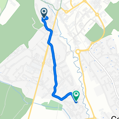
Overview
About this route
Great mountain bike loop along the highest ridge in the Juras
- -:--
- Duration
- 34.7 km
- Distance
- 1,216 m
- Ascent
- 1,215 m
- Descent
- ---
- Avg. speed
- ---
- Max. altitude

Route highlights
Points of interest along the route
Point of interest after 13.2 km
Col de la Faucille
Point of interest after 17.6 km
Petit Montrond
Point of interest after 19.8 km
Grand Montrond
Point of interest after 22.4 km
Pas de l'Echine 1590m
Point of interest after 23 km
Colomby de Gex - 1689 metres
Continue with Bikemap
Use, edit, or download this cycling route
You would like to ride Faucille unpaved, Colomby de Gex or customize it for your own trip? Here is what you can do with this Bikemap route:
Free features
- Save this route as favorite or in collections
- Copy & plan your own version of this route
- Sync your route with Garmin or Wahoo
Premium features
Free trial for 3 days, or one-time payment. More about Bikemap Premium.
- Navigate this route on iOS & Android
- Export a GPX / KML file of this route
- Create your custom printout (try it for free)
- Download this route for offline navigation
Discover more Premium features.
Get Bikemap PremiumFrom our community
Other popular routes starting in Gex
 2004 ツール移動アルプス2
- Distance
- 235.5 km
- Ascent
- 1,581 m
- Descent
- 1,886 m
- Location
- Gex, Auvergne-Rhône-Alpes, France
 3 Mijoux - Bellegarde - Gex
- Distance
- 69.6 km
- Ascent
- 400 m
- Descent
- 1,003 m
- Location
- Gex, Auvergne-Rhône-Alpes, France
 Faucille unpaved, Colomby de Gex
- Distance
- 34.7 km
- Ascent
- 1,216 m
- Descent
- 1,215 m
- Location
- Gex, Auvergne-Rhône-Alpes, France
 Stef@ns Tour zur Tour 2004 8. Etappe vom 23.07.04
- Distance
- 172.7 km
- Ascent
- 1,741 m
- Descent
- 2,128 m
- Location
- Gex, Auvergne-Rhône-Alpes, France
 Gex - La Faucille - St Sergue - Gex
- Distance
- 60.1 km
- Ascent
- 1,139 m
- Descent
- 1,140 m
- Location
- Gex, Auvergne-Rhône-Alpes, France
 Vesancy-Jura
- Distance
- 33.8 km
- Ascent
- 1,132 m
- Descent
- 1,128 m
- Location
- Gex, Auvergne-Rhône-Alpes, France
 Balcon du Léman
- Distance
- 27.9 km
- Ascent
- 1,241 m
- Descent
- 1,241 m
- Location
- Gex, Auvergne-Rhône-Alpes, France
 retour
- Distance
- 2.4 km
- Ascent
- 23 m
- Descent
- 152 m
- Location
- Gex, Auvergne-Rhône-Alpes, France
Open it in the app