

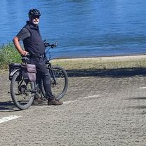
Ahrweilwer - Blankenheim
A cycling route starting in Bad Neuenahr-Ahrweiler, Rhineland-Palatinate, Germany.
Overview
About this route
- -:--
- Duration
- 68.6 km
- Distance
- 536 m
- Ascent
- 167 m
- Descent
- ---
- Avg. speed
- ---
- Max. altitude
Continue with Bikemap
Use, edit, or download this cycling route
You would like to ride Ahrweilwer - Blankenheim or customize it for your own trip? Here is what you can do with this Bikemap route:
Free features
- Save this route as favorite or in collections
- Copy & plan your own version of this route
- Sync your route with Garmin or Wahoo
Premium features
Free trial for 3 days, or one-time payment. More about Bikemap Premium.
- Navigate this route on iOS & Android
- Export a GPX / KML file of this route
- Create your custom printout (try it for free)
- Download this route for offline navigation
Discover more Premium features.
Get Bikemap PremiumFrom our community
Other popular routes starting in Bad Neuenahr-Ahrweiler
 From Bad Neuenahr-Ahrweiler to Blankenheim
- Distance
- 75 km
- Ascent
- 1,156 m
- Descent
- 786 m
- Location
- Bad Neuenahr-Ahrweiler, Rhineland-Palatinate, Germany
 Winterroute 1
- Distance
- 36.8 km
- Ascent
- 381 m
- Descent
- 381 m
- Location
- Bad Neuenahr-Ahrweiler, Rhineland-Palatinate, Germany
 Ahrweilwer - Blankenheim
- Distance
- 68.6 km
- Ascent
- 536 m
- Descent
- 167 m
- Location
- Bad Neuenahr-Ahrweiler, Rhineland-Palatinate, Germany
 Stammtischroute Ahrtal
- Distance
- 35.4 km
- Ascent
- 216 m
- Descent
- 218 m
- Location
- Bad Neuenahr-Ahrweiler, Rhineland-Palatinate, Germany
 Runde bei Gerlinde und Michel
- Distance
- 50.2 km
- Ascent
- 346 m
- Descent
- 482 m
- Location
- Bad Neuenahr-Ahrweiler, Rhineland-Palatinate, Germany
 2 Ahrweiler - Kobern - Gondorf
- Distance
- 64.6 km
- Ascent
- 98 m
- Descent
- 127 m
- Location
- Bad Neuenahr-Ahrweiler, Rhineland-Palatinate, Germany
 Markus Hohe Acht-Runde
- Distance
- 118.6 km
- Ascent
- 1,760 m
- Descent
- 1,748 m
- Location
- Bad Neuenahr-Ahrweiler, Rhineland-Palatinate, Germany
 Lust und Genuß im Ahrtal 2012 - RTF des Radsportverein Sturmvogel Bad Neuenahr-Ahrweiler 1890 e.V. - 74 km Strecke
- Distance
- 76.3 km
- Ascent
- 818 m
- Descent
- 818 m
- Location
- Bad Neuenahr-Ahrweiler, Rhineland-Palatinate, Germany
Open it in the app