06 W Valmasque Sud 9K
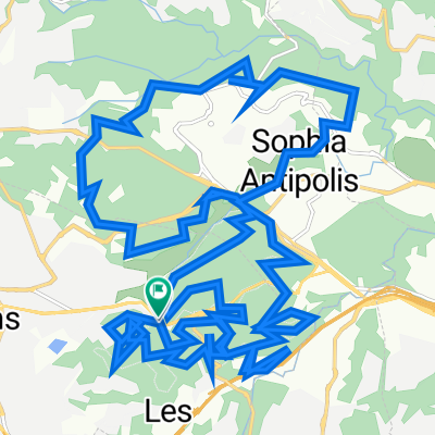
A cycling route starting in Mougins, Provence-Alpes-C么te d'Azur Region, France.
Overview
About this route
- -:--
- Duration
- 9 km
- Distance
- 156 m
- Ascent
- 160 m
- Descent
- ---
- Avg. speed
- ---
- Avg. speed
Route quality
Waytypes & surfaces along the route
Waytypes
Path
5.1 km
(57 %)
Track
2.8 km
(31 %)
Surfaces
Paved
2.1 km
(23 %)
Unpaved
3.9 km
(43 %)
Pebblestone
1.8 km
(21 %)
Ground
1.5 km
(17 %)
Continue with Bikemap
Use, edit, or download this cycling route
You would like to ride 06 W Valmasque Sud 9K or customize it for your own trip? Here is what you can do with this Bikemap route:
Free features
- Save this route as favorite or in collections
- Copy & plan your own version of this route
- Sync your route with Garmin or Wahoo
Premium features
Free trial for 3 days, or one-time payment. More about Bikemap Premium.
- Navigate this route on iOS & Android
- Export a GPX / KML file of this route
- Create your custom printout (try it for free)
- Download this route for offline navigation
Discover more Premium features.
Get Bikemap PremiumFrom our community
Other popular routes starting in Mougins
- Bob & Phil
- Distance
- 57.3 km
- Ascent
- 589 m
- Descent
- 553 m
- Location
- Mougins, Provence-Alpes-C么te d'Azur Region, France
- 06 W Valmasque Sud 9K
- Distance
- 9 km
- Ascent
- 156 m
- Descent
- 160 m
- Location
- Mougins, Provence-Alpes-C么te d'Azur Region, France
- Cap Ferrat
- Distance
- 40.2 km
- Ascent
- 242 m
- Descent
- 405 m
- Location
- Mougins, Provence-Alpes-C么te d'Azur Region, France
- Office -- Home
- Distance
- 12 km
- Ascent
- 81 m
- Descent
- 217 m
- Location
- Mougins, Provence-Alpes-C么te d'Azur Region, France
- 88km loop from Mougins
- Distance
- 87.9 km
- Ascent
- 1,482 m
- Descent
- 1,483 m
- Location
- Mougins, Provence-Alpes-C么te d'Azur Region, France
- Le Loup
- Distance
- 57.6 km
- Ascent
- 882 m
- Descent
- 910 m
- Location
- Mougins, Provence-Alpes-C么te d'Azur Region, France
- mgn grss 48
- Distance
- 48.6 km
- Ascent
- 642 m
- Descent
- 640 m
- Location
- Mougins, Provence-Alpes-C么te d'Azur Region, France
- Mougins-Greo les neiges-Canaux
- Distance
- 116.8 km
- Ascent
- 1,781 m
- Descent
- 1,724 m
- Location
- Mougins, Provence-Alpes-C么te d'Azur Region, France
Open it in the app