

Leichte MTB Abendrunde mit viel Abwechslung
A cycling route starting in Bonn, North Rhine-Westphalia, Germany.
Overview
About this route
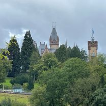
Everything included, inclines, lots of asphalt kilometers, fields, forest paths, two staircases at Birlinghoven Castle, beautiful MTB descents in the forest, the mysterious 'S' hiking trail, ice cream shop in Hangelar and, in the end, cycling back along the Rhine with the evening sun behind us, passing by 'Rheinlust' and 'Blauen Affen'.
- -:--
- Duration
- 31.9 km
- Distance
- 275 m
- Ascent
- 281 m
- Descent
- ---
- Avg. speed
- 174 m
- Max. altitude
Route quality
Waytypes & surfaces along the route
Waytypes
Quiet road
10.5 km
(33 %)
Path
8 km
(25 %)
Surfaces
Paved
21.4 km
(67 %)
Unpaved
2.2 km
(7 %)
Asphalt
19.2 km
(60 %)
Concrete
1.3 km
(4 %)
Continue with Bikemap
Use, edit, or download this cycling route
You would like to ride Leichte MTB Abendrunde mit viel Abwechslung or customize it for your own trip? Here is what you can do with this Bikemap route:
Free features
- Save this route as favorite or in collections
- Copy & plan your own version of this route
- Sync your route with Garmin or Wahoo
Premium features
Free trial for 3 days, or one-time payment. More about Bikemap Premium.
- Navigate this route on iOS & Android
- Export a GPX / KML file of this route
- Create your custom printout (try it for free)
- Download this route for offline navigation
Discover more Premium features.
Get Bikemap PremiumFrom our community
Other popular routes starting in Bonn
 Bonn - Remagen - Birresdorf - Godesberg - Bonn
- Distance
- 57.9 km
- Ascent
- 520 m
- Descent
- 519 m
- Location
- Bonn, North Rhine-Westphalia, Germany
 BRT2016-DI: Ins Drachenfelser Ländchen - PSF des Radsportbezirk Mittelrhein-Süd beim BRT 2016 in Bonn - 71 km Strecke
- Distance
- 72.5 km
- Ascent
- 609 m
- Descent
- 610 m
- Location
- Bonn, North Rhine-Westphalia, Germany
 Winterfeierabendrunde an die Sieg
- Distance
- 39.5 km
- Ascent
- 182 m
- Descent
- 182 m
- Location
- Bonn, North Rhine-Westphalia, Germany
 BRT2016-SA: westwärts.. - RTF des Radsportbezirk Mittelrhein-Süd beim BRT 2016 in Bonn - 100 km Strecke einer Super-Pfeil-Such-Fahrt
- Distance
- 100.8 km
- Ascent
- 222 m
- Descent
- 222 m
- Location
- Bonn, North Rhine-Westphalia, Germany
 Ahrtal-Eifel-Kottenforst
- Distance
- 80.9 km
- Ascent
- 925 m
- Descent
- 910 m
- Location
- Bonn, North Rhine-Westphalia, Germany
 Drachenfels-Milchhäuschen
- Distance
- 38.8 km
- Ascent
- 588 m
- Descent
- 585 m
- Location
- Bonn, North Rhine-Westphalia, Germany
 Siegtour
- Distance
- 44.5 km
- Ascent
- 173 m
- Descent
- 172 m
- Location
- Bonn, North Rhine-Westphalia, Germany
 Venusbergtour 02
- Distance
- 17.5 km
- Ascent
- 289 m
- Descent
- 280 m
- Location
- Bonn, North Rhine-Westphalia, Germany
Open it in the app