
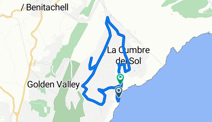
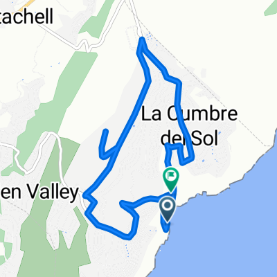
Cala del Moraig - Puig de la Llorença
A cycling route starting in Benitachell, Valencia, Spain.
Overview
About this route
- -:--
- Duration
- 8.3 km
- Distance
- 754 m
- Ascent
- 889 m
- Descent
- ---
- Avg. speed
- ---
- Max. altitude
Continue with Bikemap
Use, edit, or download this cycling route
You would like to ride Cala del Moraig - Puig de la Llorença or customize it for your own trip? Here is what you can do with this Bikemap route:
Free features
- Save this route as favorite or in collections
- Copy & plan your own version of this route
- Sync your route with Garmin or Wahoo
Premium features
Free trial for 3 days, or one-time payment. More about Bikemap Premium.
- Navigate this route on iOS & Android
- Export a GPX / KML file of this route
- Create your custom printout (try it for free)
- Download this route for offline navigation
Discover more Premium features.
Get Bikemap PremiumFrom our community
Other popular routes starting in Benitachell
 Runde 1
- Distance
- 9.1 km
- Ascent
- 298 m
- Descent
- 563 m
- Location
- Benitachell, Valencia, Spain
 Cala Moraig - Puig de la Lorença
- Distance
- 3.7 km
- Ascent
- 675 m
- Descent
- 333 m
- Location
- Benitachell, Valencia, Spain
 Cala Moraig - Puig de la Lorença en 2009
- Distance
- 5 km
- Ascent
- 592 m
- Descent
- 250 m
- Location
- Benitachell, Valencia, Spain
 Kurze Ausfahrt durch Benitachell/el Poble Nou de Benitatxell
- Distance
- 3.3 km
- Ascent
- 209 m
- Descent
- 209 m
- Location
- Benitachell, Valencia, Spain
 Cala del Moraig - Puig de la Llorença
- Distance
- 8.3 km
- Ascent
- 754 m
- Descent
- 889 m
- Location
- Benitachell, Valencia, Spain
 subida puig llorença
- Distance
- 4.1 km
- Ascent
- 452 m
- Descent
- 94 m
- Location
- Benitachell, Valencia, Spain
 Benitatxell - Puig de la Lorença
- Distance
- 4.3 km
- Ascent
- 419 m
- Descent
- 141 m
- Location
- Benitachell, Valencia, Spain
 CumbreDelSol-Calpe-Moraira-CumbreDelSol
- Distance
- 49.1 km
- Ascent
- 696 m
- Descent
- 696 m
- Location
- Benitachell, Valencia, Spain
Open it in the app