

Pinehurst Rd (hairpin - skyline)
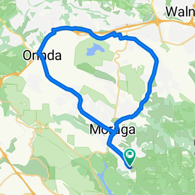
A cycling route starting in Moraga, California, United States.
Overview
About this route
10.0% grade (however, a friend of mine got 9.2% using his altimeter, a more accurate #, imo.)<br /> <br />Using bikemap's more precise #'s (not their round-offs): <br />distance: .492 miles <br />start elevation: 987'<br />end elevation: 1246' <br />net gain: 259'
- -:--
- Duration
- 0.8 km
- Distance
- 97 m
- Ascent
- 25 m
- Descent
- ---
- Avg. speed
- 391 m
- Max. altitude
Route quality
Waytypes & surfaces along the route
Surfaces
Paved
0.8 km
(100 %)
Asphalt
0.8 km
(100 %)
Continue with Bikemap
Use, edit, or download this cycling route
You would like to ride Pinehurst Rd (hairpin - skyline) or customize it for your own trip? Here is what you can do with this Bikemap route:
Free features
- Save this route as favorite or in collections
- Copy & plan your own version of this route
- Sync your route with Garmin or Wahoo
Premium features
Free trial for 3 days, or one-time payment. More about Bikemap Premium.
- Navigate this route on iOS & Android
- Export a GPX / KML file of this route
- Create your custom printout (try it for free)
- Download this route for offline navigation
Discover more Premium features.
Get Bikemap PremiumFrom our community
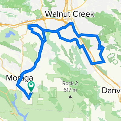
Other popular routes starting in Moraga
 Moraga Lafayette Loop
- Distance
- 32.9 km
- Ascent
- 254 m
- Descent
- 262 m
- Location
- Moraga, California, United States
 Grizzly Peak Century Tour South Loop
- Distance
- 60.5 km
- Ascent
- 1,282 m
- Descent
- 1,257 m
- Location
- Moraga, California, United States
 Camino Pablo - Moraga Way Loop
- Distance
- 29.1 km
- Ascent
- 259 m
- Descent
- 259 m
- Location
- Moraga, California, United States
 Moraga to Lafayette
- Distance
- 42 km
- Ascent
- 295 m
- Descent
- 365 m
- Location
- Moraga, California, United States
 RR/Pine/Olympic/Danville
- Distance
- 31.7 km
- Ascent
- 206 m
- Descent
- 290 m
- Location
- Moraga, California, United States
 Moraga to Berk
- Distance
- 19.3 km
- Ascent
- 562 m
- Descent
- 733 m
- Location
- Moraga, California, United States
 Robert's to College Ave
- Distance
- 14.8 km
- Ascent
- 271 m
- Descent
- 651 m
- Location
- Moraga, California, United States
 17 Sanders Ranch Rd, Moraga to 17 Sanders Ranch Rd, Moraga
- Distance
- 47.2 km
- Ascent
- 386 m
- Descent
- 386 m
- Location
- Moraga, California, United States
Open it in the app