

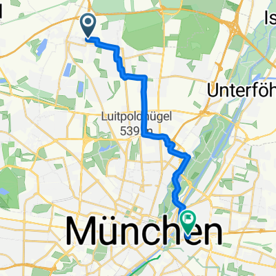
Ausfahrt durch München
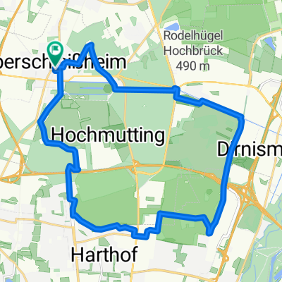
A cycling route starting in Oberschleißheim, Bavaria, Germany.
Overview
About this route
Feldmoching -Karlsfeld-Dachau -Karlsfeld -Feldmoching
- -:--
- Duration
- 22 km
- Distance
- 11 m
- Ascent
- 12 m
- Descent
- ---
- Avg. speed
- ---
- Max. altitude
Route quality
Waytypes & surfaces along the route
Waytypes
Quiet road
9.2 km
(42 %)
Track
4 km
(18 %)
Surfaces
Paved
15.2 km
(69 %)
Unpaved
4.4 km
(20 %)
Asphalt
15 km
(68 %)
Gravel
3.7 km
(17 %)
Route highlights
Points of interest along the route
Point of interest after 22 km
Continue with Bikemap
Use, edit, or download this cycling route
You would like to ride Ausfahrt durch München or customize it for your own trip? Here is what you can do with this Bikemap route:
Free features
- Save this route as favorite or in collections
- Copy & plan your own version of this route
- Sync your route with Garmin or Wahoo
Premium features
Free trial for 3 days, or one-time payment. More about Bikemap Premium.
- Navigate this route on iOS & Android
- Export a GPX / KML file of this route
- Create your custom printout (try it for free)
- Download this route for offline navigation
Discover more Premium features.
Get Bikemap PremiumFrom our community
Other popular routes starting in Oberschleißheim
 MucVien_0808
- Distance
- 486.8 km
- Ascent
- 407 m
- Descent
- 699 m
- Location
- Oberschleißheim, Bavaria, Germany
 Hasenbergl-Karlsfeld-Dachau-Oberschleißheim-Hasenbergl
- Distance
- 25.4 km
- Ascent
- 13 m
- Descent
- 15 m
- Location
- Oberschleißheim, Bavaria, Germany
 Paul-Preuß-Straße, München nach Au-Haidhausen, München
- Distance
- 14.2 km
- Ascent
- 69 m
- Descent
- 38 m
- Location
- Oberschleißheim, Bavaria, Germany
 Grashofstrasse zur Allianzarena
- Distance
- 45.4 km
- Ascent
- 10 m
- Descent
- 10 m
- Location
- Oberschleißheim, Bavaria, Germany
 Rundkurs Münchner Norden
- Distance
- 29.5 km
- Ascent
- 8 m
- Descent
- 9 m
- Location
- Oberschleißheim, Bavaria, Germany
 SunSet OSH 5 Fröttmaninger Heide Panzerwiese
- Distance
- 22.1 km
- Ascent
- 56 m
- Descent
- 54 m
- Location
- Oberschleißheim, Bavaria, Germany
 Oberweilbacher Runde
- Distance
- 28.3 km
- Ascent
- 89 m
- Descent
- 88 m
- Location
- Oberschleißheim, Bavaria, Germany
 Muc_Ingolstadt
- Distance
- 81.7 km
- Ascent
- 538 m
- Descent
- 641 m
- Location
- Oberschleißheim, Bavaria, Germany
Open it in the app